
 What made the Battle of Shiloh significant? Fought in April 1862, Shiloh marked the bloodiest fighting of the Civil War to that time with more than 20,000 casualties, and the narrow Union victory paved the way for Grant to ultimately secure the railroads and the Mississippi River which greatly hampered the Confederacy. Shiloh National Military Park, TN was established in 1894 making it one of the oldest units in the National Park system.
Visitor Rating (write your own review below)
ILNP Rating ![]()
 ILNP Park Review
Our Visit. We visited Shiloh National Military Park in July as a day trip while visiting the area
Our Weather. high 80s and partly cloudy
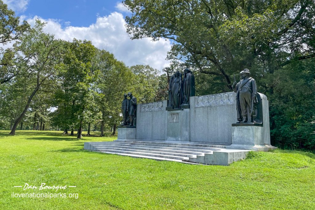
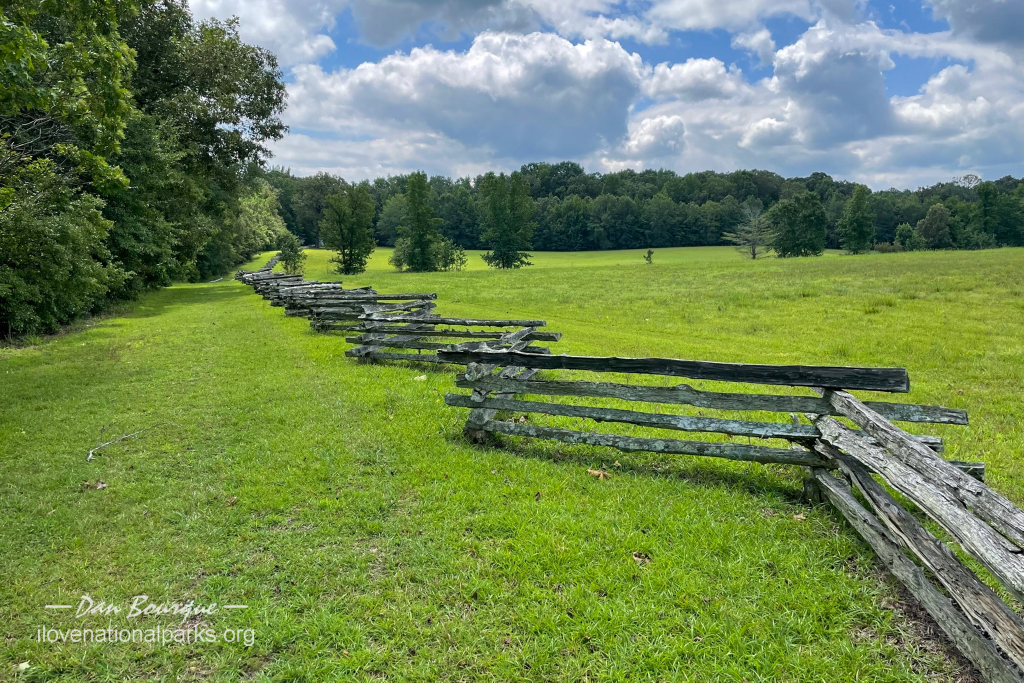
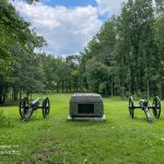
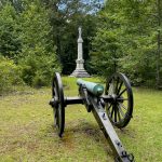
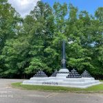
The large Confederate Memorial is on the tour near the center of the battlefield
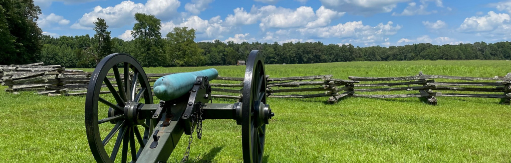
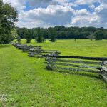
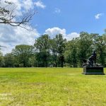
Overall Impression. Shiloh is big, and until you drive through the park, it’s tough to get a feel for the immense scale of this battle. If you’ve been to any of the major battlefields of the Civil War like Gettysburg or Chickamauga, Shiloh will feel somewhat familiar with well-kept fields and forests lined with cannons and monuments to commemorate the major scenes of fighting and those who fought. Like these other battlefields, the National Park Service has tried to preserve the area close to how it looked during the fighting, and roads and trails with descriptive signs tell the story of the battle, a two-day affair fought on 6-7 April, 1862 and ultimately a Union victory.
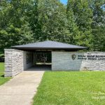
Visiting. The best way to start a visit to Shiloh Battlefield is to watch the video at the Visitor Center. It’s not short, but it’s well done and will give you a great overview of the battle’s main movements–this helps tremendously to put the individual spots you’ll visit into the larger context of the battle. After seeing the video, take a few minutes to visit Shiloh National Cemetery before starting the battlefield tour.
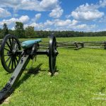
Fighting at Duncan Field lasted for seven hours on the first day of the battle
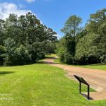
The battlefield tour is best done via vehicle, and it’s all self-guided. The driving tour criss-crosses the battlefield on several roads, and it’s not all in order, so it helps to have a park map or the NPS app and pay careful attention to the “driving tour” signs along the way. At each stop, signs orient you to the area and explain the actions that took place near the spot. A few spots offer easy hikes, and if you have a little time, it’s worth it to take a stroll away from the road where you can get a better feel for the terrain and imagine what it must have been like during the battle. We hiked at stop 6, Rhea Field, to view one of the Confederate mass graves. We also hiked into the “Hornet’s Nest” at stop 10, site of fierce fighting in thick woods that ultimately ended in 2,000 Union troops being cut off and surrendering. A short hike at stop 18, the Peach Orchard, leads to the tiny recreated cabin of W. Manse George which you can walk into and see the spartan accommodations of life in this area at the time of the battle.
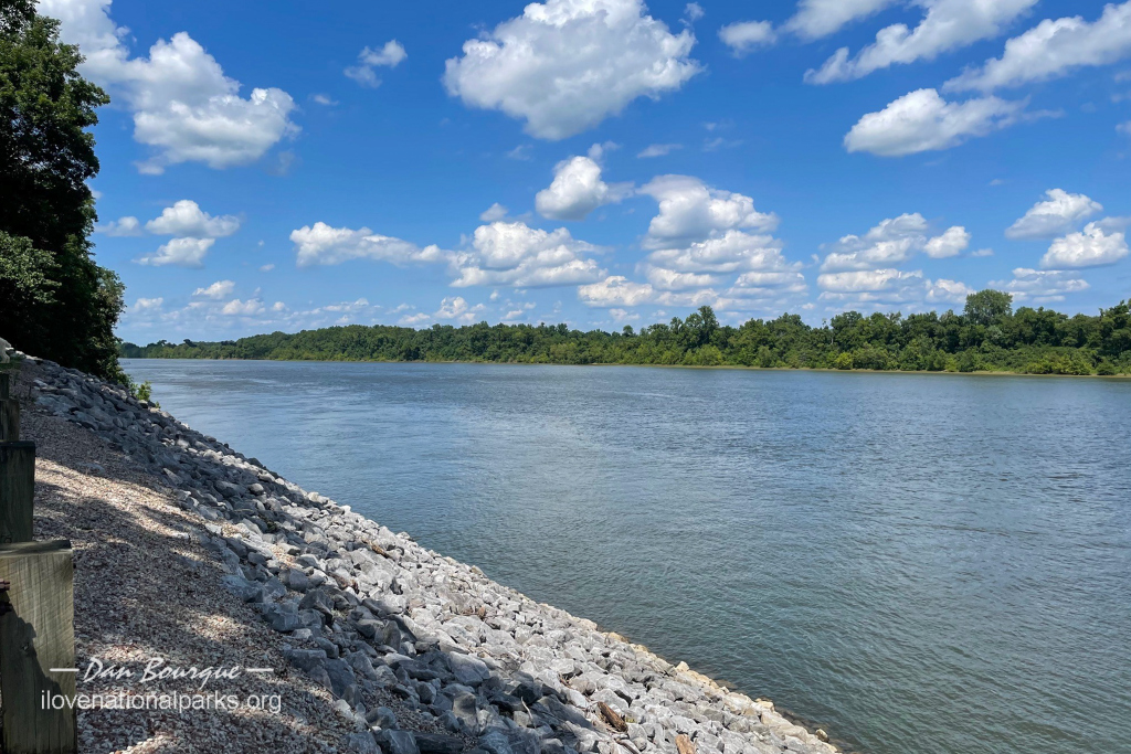
Pittsburg Landing where Gen Buell’s reinforcements arrived to turn the tide for the Union
Along the tour, you’ll see hundreds of historic markers and dozens of marble and bronze monuments erected after the war by states that participated in the battle. You can read as many or few of these as you want depending on how much of a Civil War buff you are and how interested you are in details, but just the major stops and primary signs will give you a good overview of the fighting. One of the more interesting stops include stop 16, the Field Hospital, which marked the spot of one of the earliest treatment facilities found on a battlefield which despite its primitive techniques saved many lives. Nearby stop 17 marks the spot where the Confederate commander General Johnston finally succumbed to a bullet wound leaving the Confederate force in the hands of General P.G.T. Beauregard. One of the last stops is stop 21, Pittsburg Landing, where General Grant’s last line held on day 1 until General Buell’s army arrived and enabled a Union victory on day 2–having toured the entire battlefield, you get a feel for just how far the Confederates pushed the Union and why the battle was so bloody.
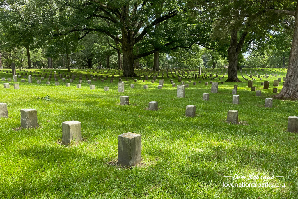
Rows of tombstones, mostly unmarked graves, at Shiloh National Cemetery
Shiloh National Cemetery. Shortly after the Civil War, in 1866, the Union troops were reinterred in graves at Shiloh National Cemetery overlooking Pittsburg Landing and the Tennessee River. This beautifully situated cemetery is reminiscent of others of the era, but I was surprised by the sheer number of unknown graves, 2,357 of the 3,584 Union graves on the site marked with simple blocks and no name. In contrast, the Confederate dead were left in mass graves, five of which have been located and can be visited on the battlefield.
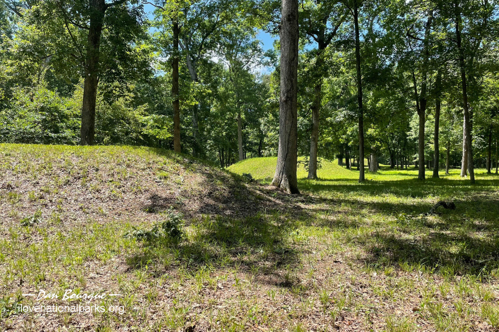
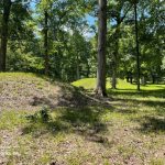
Multiple mounds mark the town site in Shiloh Indian Mounds NHL
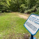
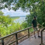
Shiloh Indian Mounds National Historic Landmark. Located completely within the battlefield boundary is Shiloh Indian Mounds. This was the site of an ancient Native American settlement about 800 years ago. Little is known about the culture other than they engaged in widespread trade based on the artifacts found. The mounds can be seen from the road, but the Shiloh Indian Mounds Interpretive Trail takes you through the mounds in the “village” and up on top of the chief’s mound overlooking the Tennessee River.
 Shiloh National Military Park – Corinth Unit. After the main battle at Shiloh, the Confederates retreated to Corinth, Mississippi to protect the important rail lines. A massive Union force dislodged the Confederates in a siege and later withstood a counterattack in October 1862, paving the way for General Grant to take Vicksburg and control the Mississippi River. Fourteen individual tracts make up the Corinth Unit including the main Civil War Interpretive Center near Battery Robinett, site of fierce resistance during the counterattack. The Corinth Unit is about a 30-minute drive south from the main Shiloh Battlefield.
 Corinth National Cemetery. Like the Shiloh National Cemetery, Corinth National Cemetery was created after the war and serves as the final resting place for around 6,000 Union troops killed near this area.
Sunken Road provides a trail into the thick woods of the Hornet’s Nest area
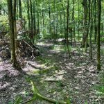
Suggestions. This area can get very hot, and much of the driving tour is unshaded, so be prepared with water and hopefully a functioning air conditioner on hot days. Many of the hikes are in the woods, and as you might expect, insects are an issue. I was bit or stung by something painful while on the trail in the Indian Mounds, and I wish I’d brought bug spray. Speaking of the Indian Mounds Interpretive Trail, the first part of the trail between the site’s parking lot and entrance and the mounds is in decent shape. The second half of the trail that loops to the south to return to the parking lot was uncharacteristically overgrown for an NPS-maintained area (and it’s where I got my bite), so you might just want to return the way you came. One final thing, you’ll see signs for the “Army of Tennessee” everywhere, and if you think it refers to the Confederate army you might be confused–this is the name of Grant’s Union army.
Nearby Towns Crump, Adamsville, Savannah (TN), Corinth (MS)
Other Nearby Attractions Trail of Tears NHT
Official NPS Website Shiloh National Battlefield Park
-
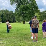
- A park volunteer demonstrates drum calls and what it was like to be a drummer during the Civil War
-
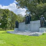
- The large Confederate Memorial is on the tour near the center of the battlefield
-
- Fighting at Duncan Field lasted for seven hours on the first day of the battle
-
- The Confederate’s brought Ruggle’s Battery to bear on Union positions at the Hornet’s Nest which preceded the Confederates taking the area
-
- The battlefield tour winds along roads through forests and fields in the park
-
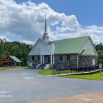
- Shiloh Church was near the site of the first fighting and gave the battle its name–the church (not the original building) is still active
-
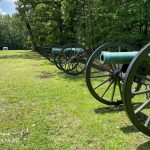
- Cannons mark some of the first fighting near Rhea Field on the southern end of the battlefield
-
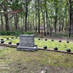
- One of several mass graves on the battlefield which marks where hundreds if not thousands of casualties were buried
-
- Sunken Road provides a trail into the thick woods of the Hornet’s Nest area
-
- This monument stands in the Hornets Nest where some of the fiercest fighting occurred
-
- The Tennessee Monument in Woolf Field where the Union attempted a counterattack on the first day of the battle
-
- Cannons aim across the Peach Orchard which was taken by the Confederates on the first day and retaken by the Union on the second
-
- This spot marks the site of the Union field hospital, one of the first of its kind so close to the battle
-
- Confederate General A. S. Johnston died of a bullet wound near this spot making him the highest ranking officer on either side to die in the war
-
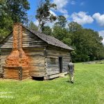
- W. Manse George cabin near the Peach Orchard–the cabin is open to view the spartan space inside
-
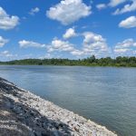
- Pittsburg Landing where Gen Buell’s reinforcements arrived to turn the tide for the Union
-
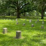
- Rows of tombstones, mostly unmarked graves, at Shiloh National Cemetery
-
- Shiloh Indian Mounds lies entirely within the boundary of Shiloh NMP
-
- Multiple mounds mark the town site in Shiloh Indian Mounds NHL
-
- The Shiloh Indian Mounds Interpretive Trail was somewhat overgrown when we traversed it in July
-
- The “Chief’s Mound,” the tallest in Shiloh Indian Mounds, overlooks the Tennessee River
Write Your Own Review
No Comments Yet