
 Santa Monica Mountains National Recreation Area, California, was established in 1978 after decades of attempts to protect these beautiful lands from further incursion. The park is actually a patchwork of public and private lands including several state parks.
Visitor Rating (write your own review below)
ILNP Rating![]()
ILNP Park Review
 Our Weather. Mostly clear and upper 80s.
Our Visit. I visited Santa Monica Mountains for two half days while in southern California in November. This visit was prior to a major wildfire in 2018 that devastated portions of the park, so current conditions may vary somewhat from my experience.
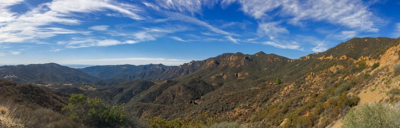
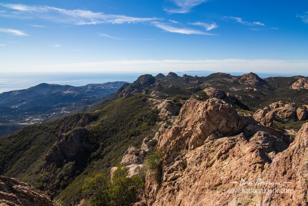
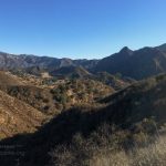
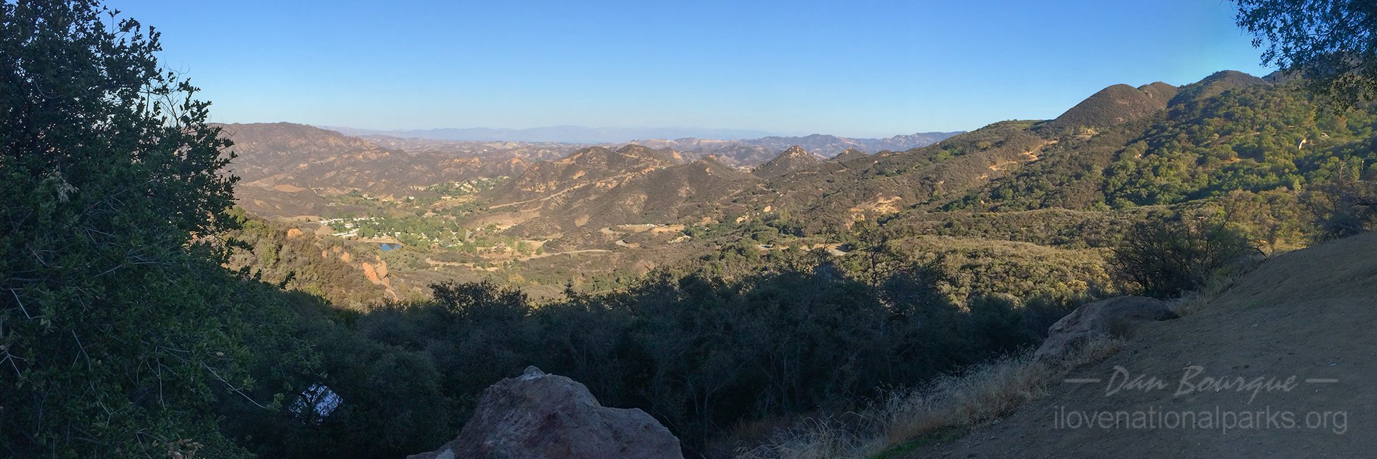
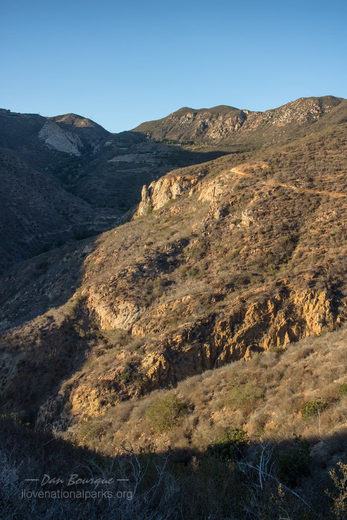
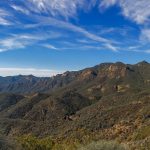
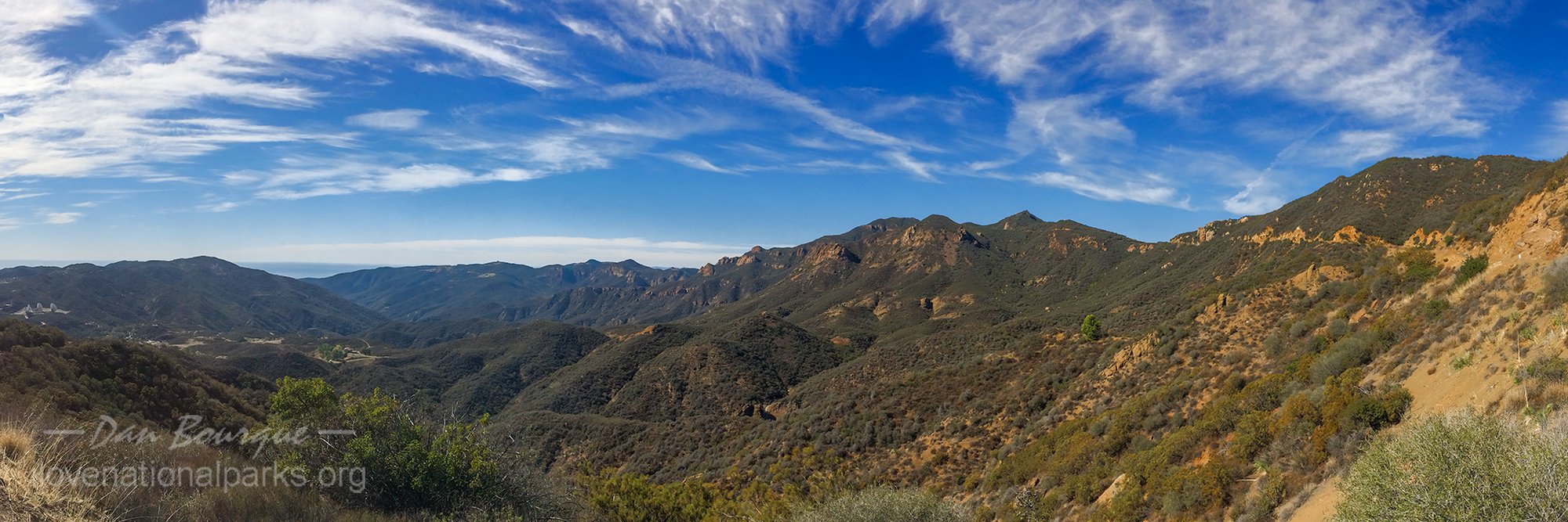
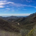
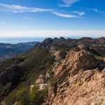
A view from Backbone Trail, this one looking northeast.
Overall Impression. Santa Monica Mountains is a surprisingly beautiful and rugged place just a stone’s throw from Los Angeles. Unlike most National Park units, only a portion of the National Recreation Area is actually NPS land, so within the boundary are many homes (many of them multi-million dollar homes), the entire town of Malibu, Pepperdine University and even some old western movie sets. Despite the numerous signs of civilization, there are plenty of remote corners to explore and enjoy whether you like walking beaches, driving curvy roads, or hiking mountain peaks.
Visiting. The beauty of the Santa Monica Mountains can be seen from your car provided you’re good with narrow, curvy roads and blind corners. In fact, the roads in the park are a major draw for motorcyclists and bicyclists. An hour or two will allow you to experience either a portion of the mountains via Mulholland Highway or the seaside via California 1, the Pacific Coast Highway. To really experience the park and get away from crowds, though, you’ll want to get out of the car and enjoy one of the park’s many trails, even a portion of the 67-mile long Backbone Trail that runs the length of the park.
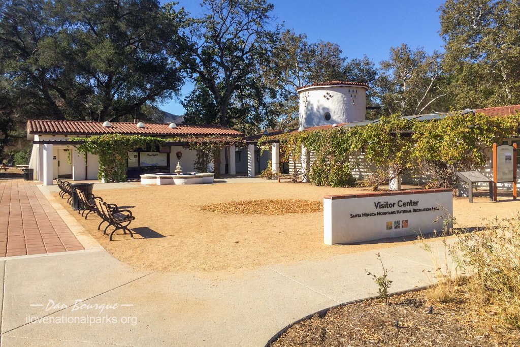
The Visitors Center is a great place to pick up trail maps and get some suggestions on how to best spend your time in the park.
The park is a patchwork of public and private lands, so there are many sections to enjoy including several California state parks. This review will focus on the National Park Service sections of the park which are concentrated in the western half of the National Recreation Area. I recommend starting with the Santa Monica Mountains NRA Visitors Center on Mulholland Highway, reachable from Thousand Oaks via Las Virgines Road and Malibu from Malibu Canyon Road. The young representative behind the desk was a wealth of great information and supplied me with descriptions and maps of the trails in the NPS sections of the park, and I found her recommendations to be spot-on. If you just want to drive and make a few stops, I recommend taking Mulholland Highway west from the visitors center, stopping briefly at Paramount Ranch, an active movie set where many Western films have been shot–be careful with your camera, though, as photos here require a permit. As you move westward, you’ll go deeper into the mountains, and the road offers plenty of panoramic views but only a few pull-offs. If you see one you like, take it!
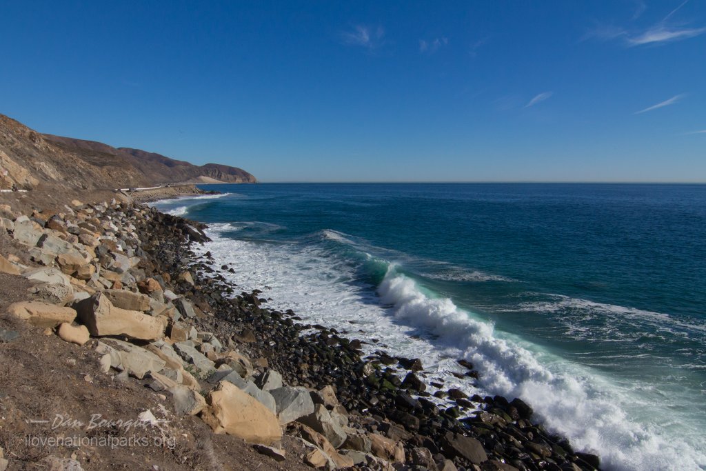
The rugged coast near Point Mugu was a great place to stop and watch the surf crash against the shore. Pacific Coast Highway runs right along the coast here.
If you don’t have much time, take Kanan Dume Road which winds along the eastern edge of the Zuma/Trancas Canyons area until meeting the Pacific Coast Highway (PCH) in Malibu. From here, you can take the PCH east back toward Los Angeles or west toward Oxnard. The east is more populated, and the west is more isolated. If you’d like a short hike, you can stop at Solstice Canyon to the east or Zuma/Trancas Canyons to the west. My first day, I hiked to the ruins of the Roberts Ranch up the cool and shady Solstice Canyon Trail and hiked back via the hill-hugging Rising Sun Trail offering views of the Pacific Ocean. A drive along the PCH to the western edge of the park will take you past the rugged and picturesque Point Mugu, one of the best sections of coast in the park, in my opinion.
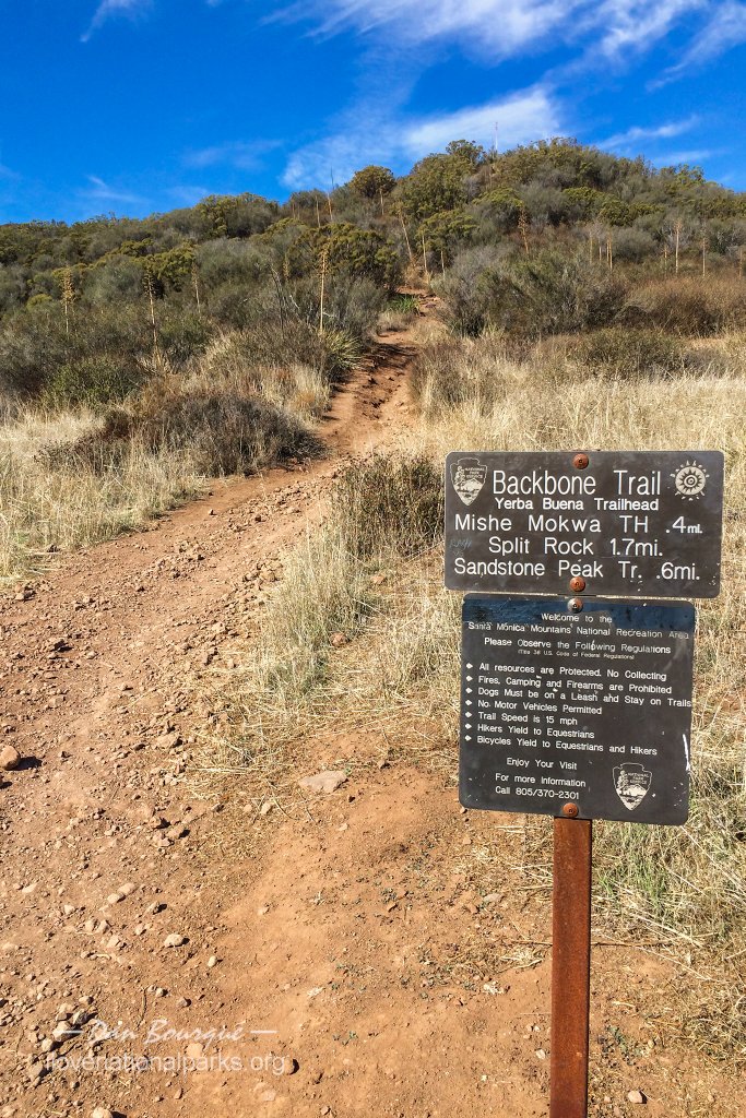
If you have more time or prefer mountains to beaches, I highly recommend the Circle X Ranch section of the park, site of an old Boy Scout Camp. This section is more remote and rugged, and has the most dramatic views of the mountains including Sandstone Peak, the highest point in the Santa Monica Range. The best access is via Little Sycamore Canyon Road which branches from Mulholland Highway and skirts along a ledge on the southern side of the peaks. There are a few great pull-outs for photos, and while this road felt safe to drive, it’s not for the timid driver or faint of heart. There are two trail-head parking areas near Sandstone Peak, the first is Mishe Mokwa/Backbone Trail, and the second is Sandstone Peak Trail. Both trails connect and are about the same distance from the peak.
View looking west from Sandstone Peak. Two of the Channel Islands, Anacapa and Santa Cruz, can be seen in the distance.
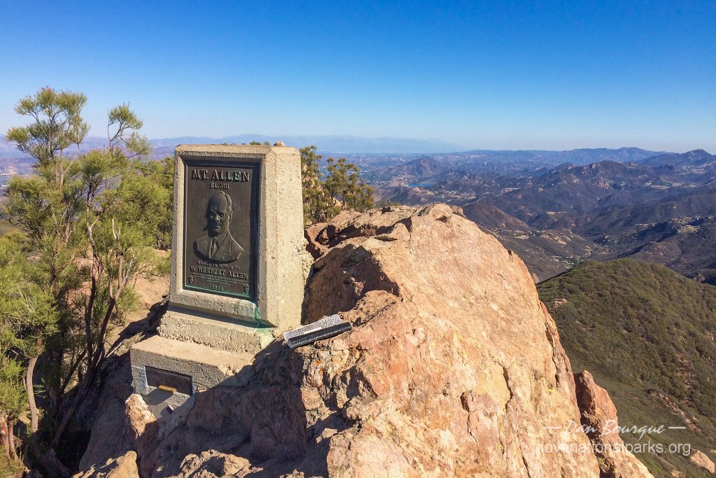
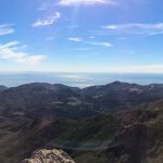
I chose Mishe Mokwa to spend more time on the Backbone Trail and wasn’t disappointed. It’s about 3 miles round trip to the peak along with more than 1,000 feet of elevation gain, so this is a serious hike. I was moving at a good clip and made the round trip in 90 minutes, but I would budget at least 2 hours to avoid rushing this great hike. The trails offer fantastic views to the north, east and south–even if you’re not going to summit, hiking even 1/2 a mile is worth the views. At the top of the peak is an incredible 360 degree view of the mountains, ocean and even the Channel Islands to the west (see Channel Islands National Park). This hike was the highlight of my time in the Santa Monica Mountains! One word of caution, the trail to Sandstone Peak splits from Backbone Trail near the end, and the final 1/4 mile is a bit of a scramble with no clear trail–just keep heading east and up. You’ll know you’ve found the top when you see the small monument proclaiming this as “Mount Allen, 3,111 feet” (don’t know when the name changed).
Back in your car, if you continue down the road toward the beach (now Yerba Buena Road), you’ll pass the site of the old Boy Scout Camp which is now a campsite. There’s not much to see here, but it does offer a great view of Sandstone Peak.
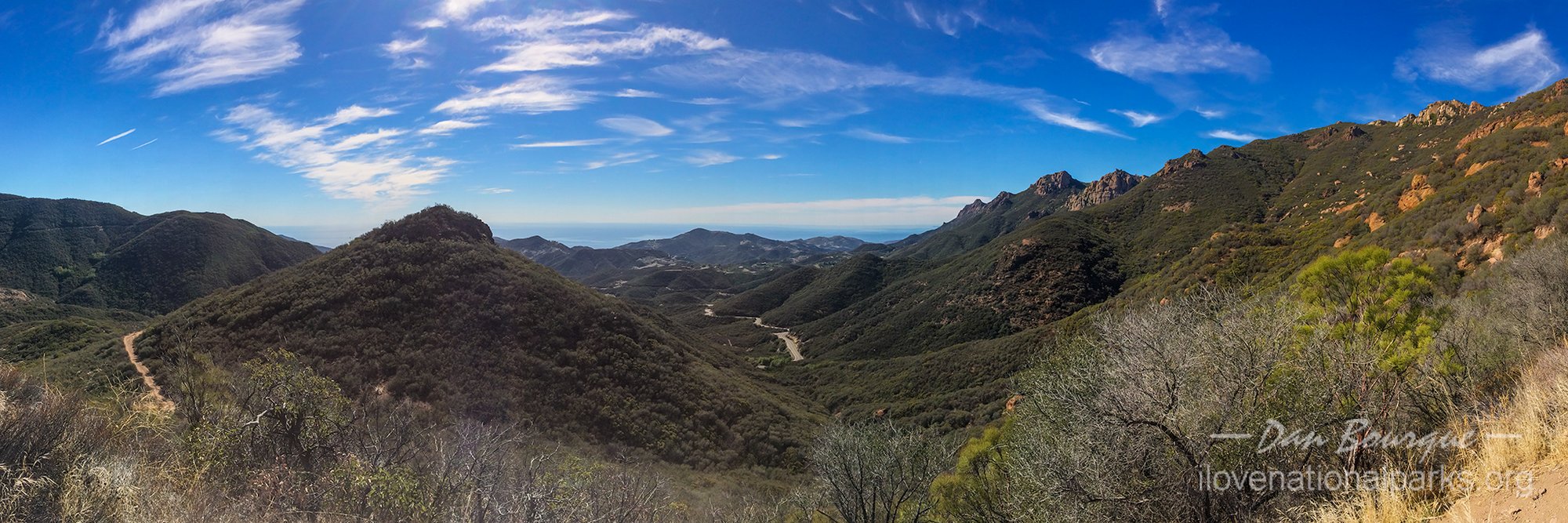
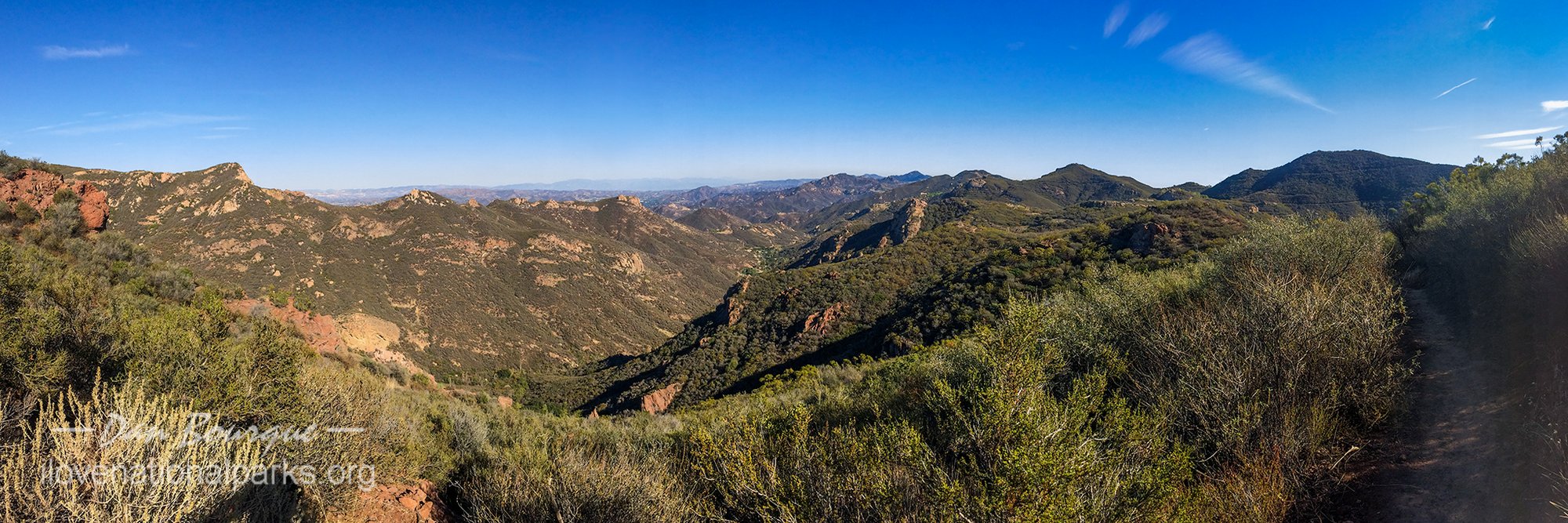
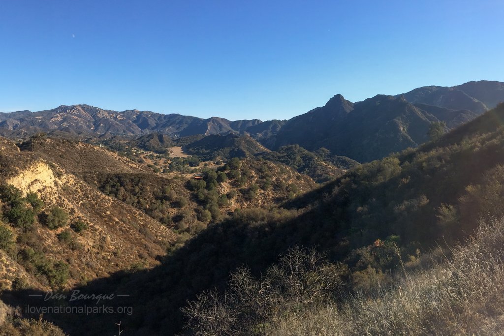
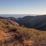
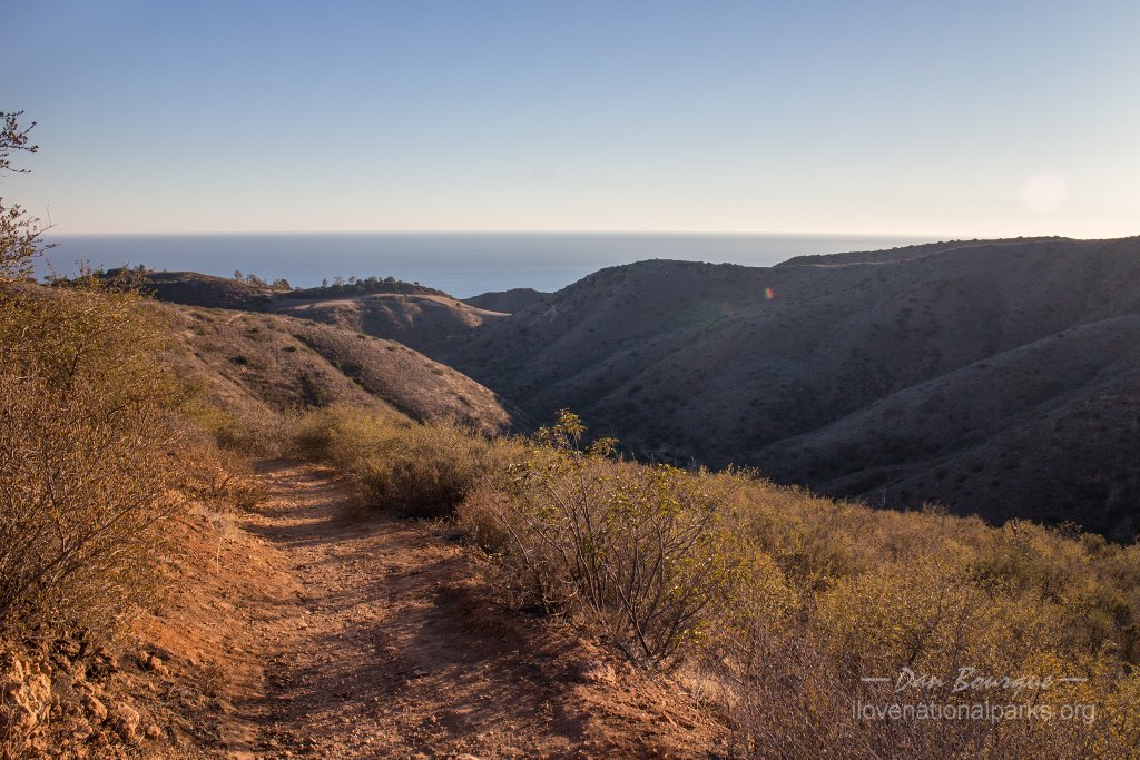
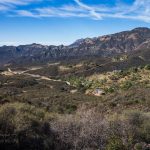
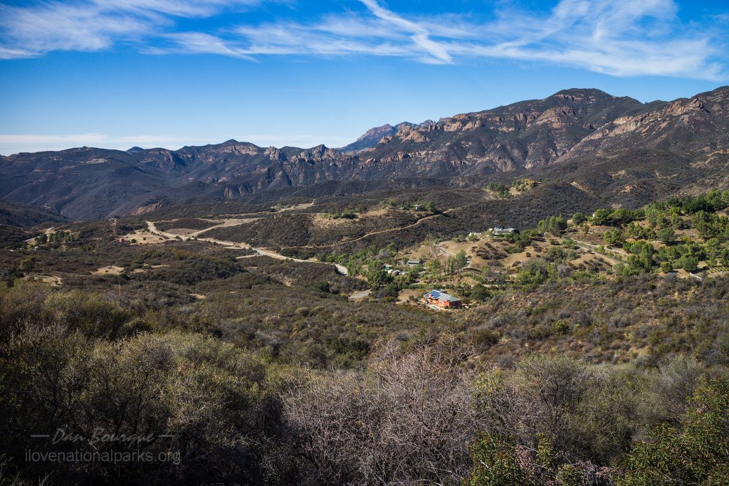
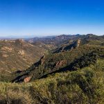
The view from Backbone Trail on the way to Sandstone Peak with Yerba Buena Road snaking through the valley.
Suggestions. Be very careful driving in this park. First, it’s easy to miss your turns–they’re not well advertised, and sometimes you have to take the diverging route to stay on your road. I missed my turn and had to double back more than once, and there aren’t many places for U-turns in the mountains. Secondly, this is a very popular area for both motorcyclists and bicyclists. This creates a double danger because if you take your eyes off the road for even two seconds, you’re bound to encounter a bicycle around a blind corner you didn’t see, and if you stop in the middle of the road, you’re libel to have a motorcycle on top of you in a hurry.
 I visited during the week, and the roads and trails were pleasingly uncrowded. However, I imagine they can be quite crowded during the weekends with the millions of people who live within two hours of the park–go during the week if you can. I found cell coverage to be good throughout the park, even in some of the canyons, but on some hikes like Solstice Canyon, I only saw two other groups of hikers in the 90 minutes I spent on the trail, so don’t expect help to come quickly if you hurt yourself. Take plenty of water and some food with you. I also recommend taking a trail map as some of the connections and signs can be confusing without a big picture map to reference.
Nearby Towns Malibu, Thousand Oaks, Oxnard, Ventura, Los Angeles (CA)
Other Nearby Attractions Satwiwa Native American Indian Culture Center, Will Rogers State Historic Park, Topanga State Park, Malibu Creek State Park, Leo Carrillo State Park, Point Mugu State Park (all within the NRA boundary), Channel Islands National Park, dozens of public beaches
Official NPS Website Santa Monica Mountains National Recreation Area
-
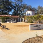
- The Visitors Center is a great place to pick up trail maps and get some suggestions on how to best spend your time in the park.
-
- View of the mountains from Mulholland Highway just west of the visitors center. The mountains get more dramatic the further west you go.
-
- Mulholland Highway offers great panoramic views like this one near the Peter Strauss Ranch.
-
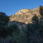
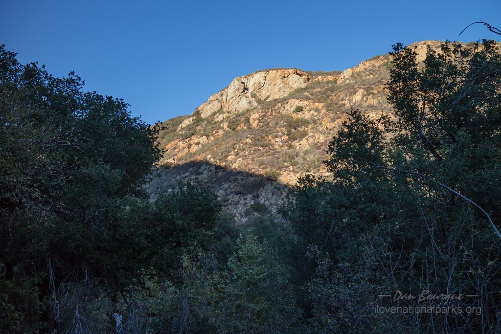
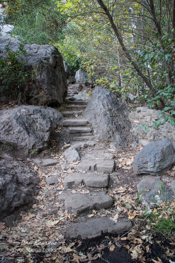
- Looking up from the Solstice Canyon Trail. The trail is shaded and considerably cooler than the surrounding landscape.
-
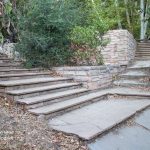
- The Solstice Canyon Trail ends at Roberts Ranch, ruins of a once beautiful home judging by the steps.
-
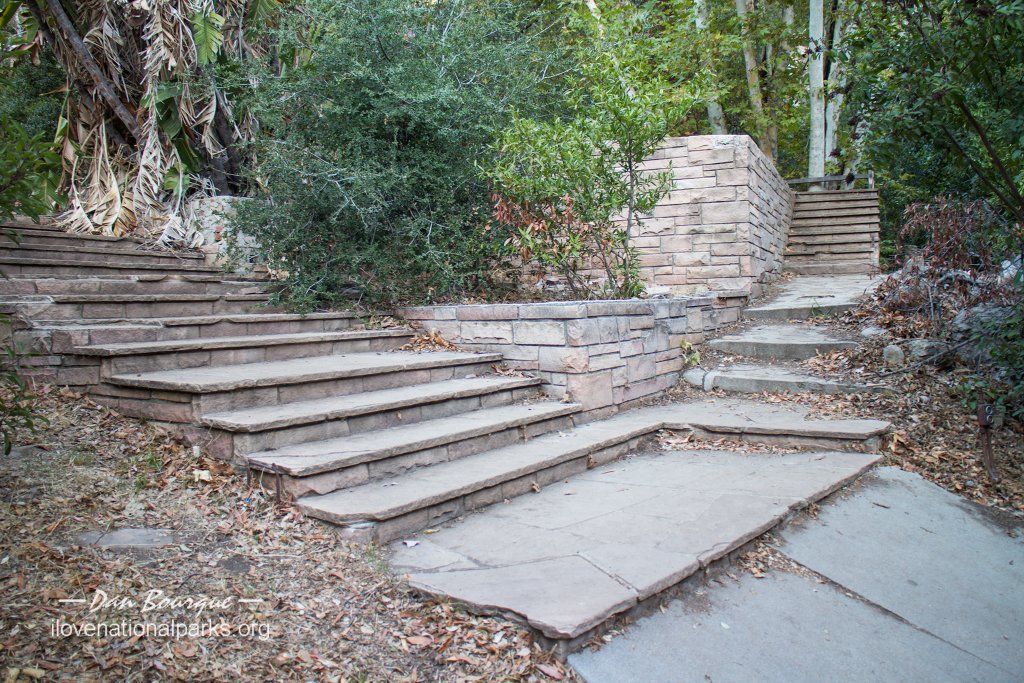
- A staircase behind Roberts Ranch leads to a waterfall, but there wasn’t even a trickle in November.
-
- Looking down into Solstice Canyon from Rising Sun Trail.
-
- Looking toward the Pacific Ocean from Rising Sun Trail near Solstice Canyon.
-
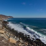
- The rugged coast near Point Mugu was a great place to stop and watch the surf crash against the shore. Pacific Coast Highway runs right along the coast here.
-
- Little Sycamore Canyon Road clings to the hillside and offers spectacular views of Sandstone Peak.
-
- There are thousands of homes within the boundaries of the NRA including these along Little Sycamore Canyon Road.
-
- The view from Backbone Trail on the way to Sandstone Peak with Yerba Buena Road snaking through the valley.
-
- A view from Backbone Trail, this one looking northeast.
-
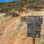
- Backbone Trail is a 67-mile trail running the length of the park. It can be accessed from a number of trail heads including this one shared with the Mishe Mokwa Trail
-
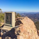
- Atop Sandstone Peak is a marker which confusingly says “Mount Allen, but the elevation is unmistakable, 3,111 feet, highest point in the Santa Monica Mountains.
-
- View looking west from Sandstone Peak. Two of the Channel Islands, Anacapa and Santa Cruz, can be seen in the distance.
-
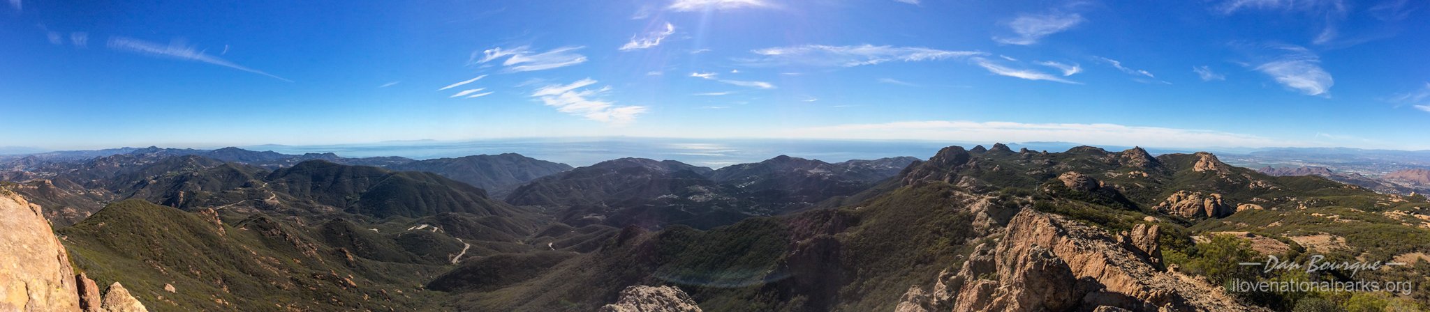
- Panoramic view looking south over the Pacific from Sandstone Peak.
Write Your Own Review
No Comments Yet