
 Pinnacles National Park, California, is located just east of US 101 about 70 miles southeast of San Jose, CA. It is home to large formations of ancient volcanic spires in a very out-of-place setting among the rolling golden hills of central California. While it’s one of the oldest National Park lands, having been declared a National Monument by Teddy Roosevelt in 1908, it’s one of the newer National Parks having been signed into law in 2013.
Visitor Rating (write your own review below)
Vigorous hike--take lots of water!
ILNP Rating![]()
Scenery![]()
Uniqueness![]()
Wildlife![]()
Diversity![]()
ILNP Park Review
In a Word. “Soaring”
“Does the eagle soar at your command and build its nest on high?” -Job 39:27
Our Visit. I had a day off during a trip to central California in June and decided to get some exercise while hiking the Pinnacles.
Our Weather. Hazy and hot; 105 degrees at 5 PM
Overall Impression. Pinnacles is a neat place to explore among hundreds of square miles of typical California brown. The monument boasts dozens of miles of hiking trails, most of them go up. The trails allow you to get right up among the densest formations of pinnacles in the park where you can get a birds-eye view of the surrounding territory while carrion birds, including the massive California condor circle right next to you.
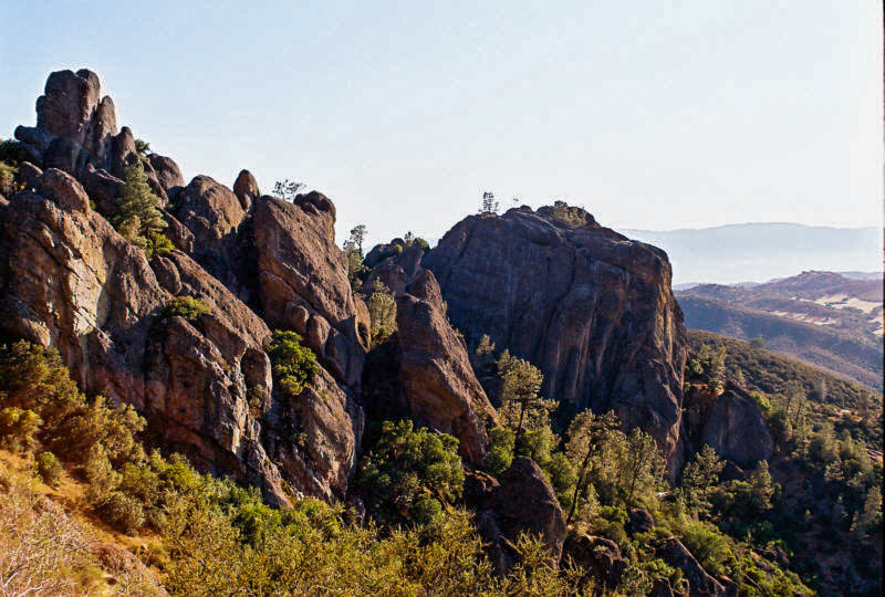
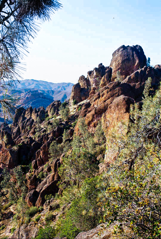
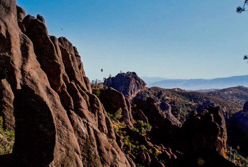
More of the view from High Peaks Trail. The rocks are a reddish black and smooth in appearance, very different from the surrounding grassy landscape (June)
Visiting. The first thing to realize before you visit is there are two visitors centers, Bear Gulch Visitors Center on the east side of the park off California 25 and the Chaparral Visitors Center on the west side off US 101 (the road is steep on this side, so large vehicles are discouraged). Both offer access to the pinnacles and other trails, but there is no road through the park. While you can get some good views of the park’s centerpiece from the visitors centers, this is a park for hiking, so bring comfortable shoes and LOTS of water! After talking to a Ranger at Bear Gulch (who talked me into buying 2 more liters of water–the recommendation in the heat is 1 liter per hour), I took the loop formed by Condor Gulch Trail and High Peaks Trail to the High Peaks area of pinnacles.
The first two miles is up (about 1,300 feet), so it’s best to take it slow and drink lots of water. You can do the same thing from the west side by taking Juniper Canyon Trail to High Peaks Trail; it’s shorter but steeper. What awaits you at the top is worth the climb. The trail winds through the formations, up stairs cut into the rock and over cliffs. This is home to many endangered California condors, so keep your eyes open. You can tell them from the vultures by their enormous size and white markings on their wings. The birds circle effortlessly just feet from you. Just be careful and take plenty of food and water for the 3-4 hour hike–I saw one other hiker in the 3-hours I was on the trail. If you aren’t up to hiking to the top, you can take the Condor Gulch Trail just a few hundred yards to get some good views, and there are other shorter trails like the Moses Spring Trail to Bear Gulch Cave. Cave, one of the caves in the park where you can see bats certain times a year (it was closed in June to protect the bats).
Suggestions. One word of advice for the trails: if you think you’ve lost the trail, you have–stop and retrace your steps until you find it. I lost the trail more than once. It would appear I was on the trail, then all of a sudden it would dead end into a creek or some bushes. When I retraced my steps, I would find where I missed a sharp turn in the trail. There are many footpaths worn down by hikers missing the turns, but the real trail is the one that is clear and unencumbered by foliage.
Nearby Towns Soledad, Greenfield, King City, San Jose (California)
Other Nearby Attractions Monterey, Big Sur
Official NPS Website Pinnacles NP
-
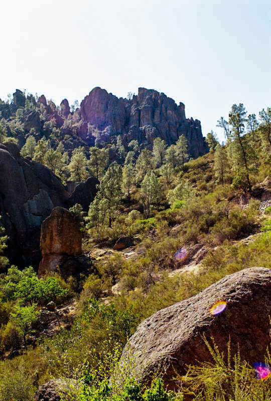
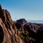
- You don’t have to hike far to get a good view of the formations. This is on Condor Gulch Trail about 200 yards from the visitors center (June)
-
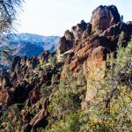
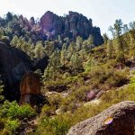
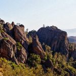
- The pinnacles appear as miles of jumbled rocks in the High Peaks area (June)
-
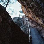
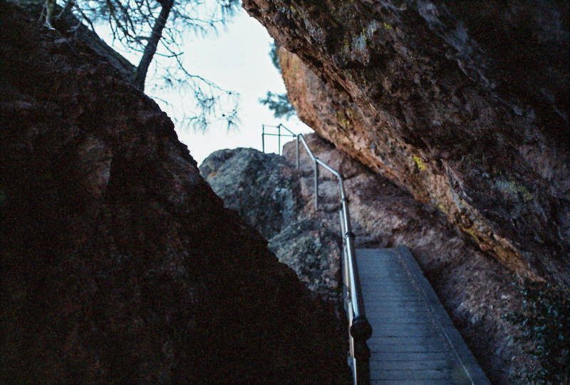
- The High Peaks Trail is steep and confined in places. I had to stoop and lean to get through this opening (June)
-
- More of the view from High Peaks Trail. The rocks are a reddish black and smooth in appearance, very different from the surrounding grassy landscape (June)
-
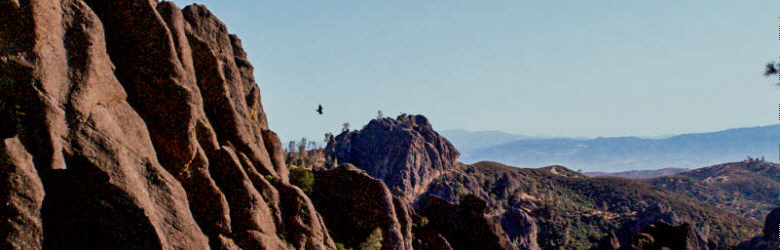
- Here a California Condor soars over the High Peaks. Most of the circling birds you’ll see in the park are vultures, but you can tell the condors by their size and white markings on the wings (June)
Write Your Own Review