
 With iconic sites like Horseshoe Bend within its boundaries, Glen Canyon National Recreation Area is not only a place for boating but a great place for hiking and incredible scenery. Straddling Utah and Arizona, the park is home to Lake Powell, one of the largest and scenic manmade lakes in America. It was established in 1972, 6 years after the completion of the Glen Canyon Dam.
Visitor Rating (write your own review below)
More than just a lake
ILNP Rating ![]()
ILNP Park Review
Our Visit. We visited the southern area of Glen Canyon NRA while on a trip to nearby Page, Arizona in April.
Our Weather. 50-70s and mostly sunny
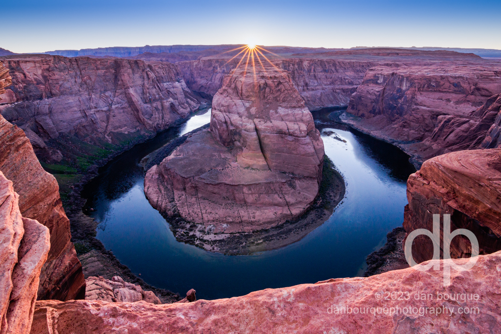
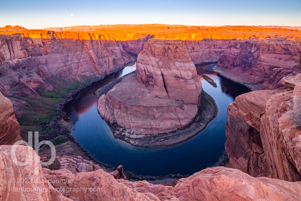
Horseshoe Bend is one of the icons of the American West that should be on everyone’s bucket list
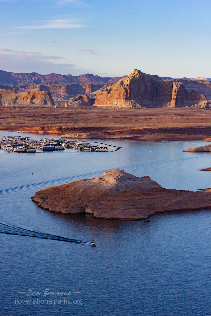
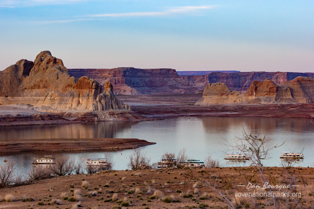
Overall Impression. The central feature of Glen Canyon NRA is Lake Powell, a beautiful place for recreation on the water, but it’s also a great place for hiking and some breathtaking scenery for those not inclined to get out on the water–this “non-water” activity is the focus of this review. Even if all you do is visit Horseshoe Bend, its worth going out of your way to make this a stop, but while you’re there, take advantage of some of the great and easy hikes in the area to see other fantastic and iconic features of the American Southwest including red-and-white cliffs, canyons, and slickrock formations. The lake level was down about 150 feet from max when we visited (that’s a lot of missing water…), but that didn’t detract much from the non-water activities.
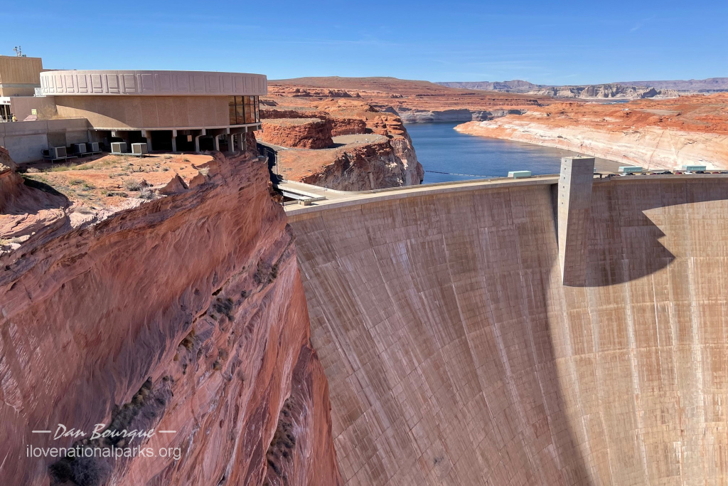
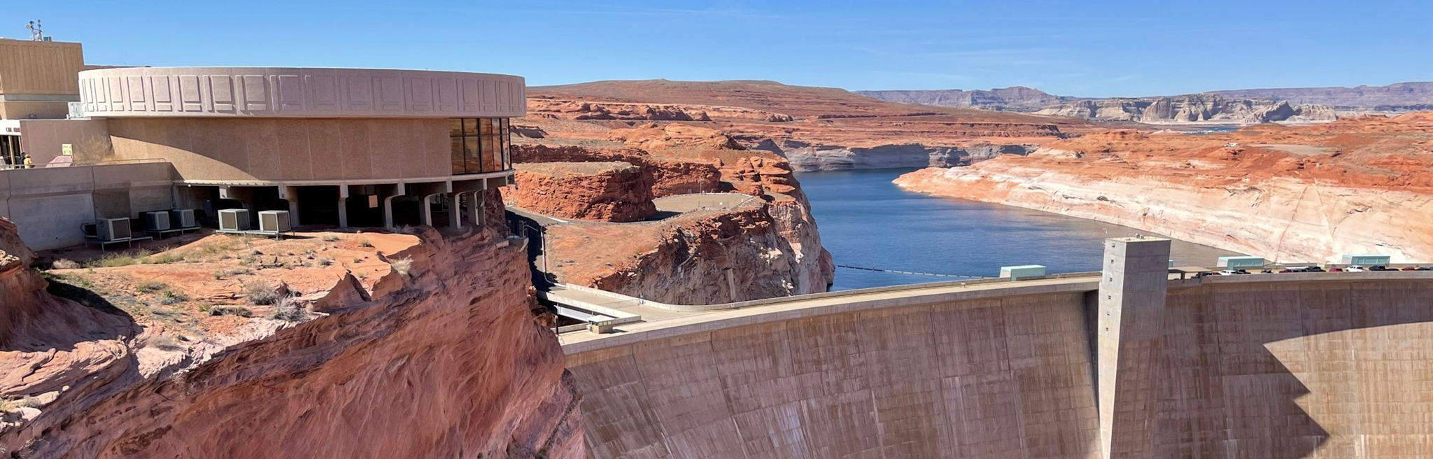
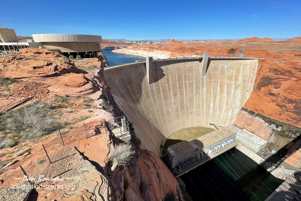
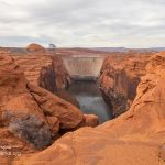
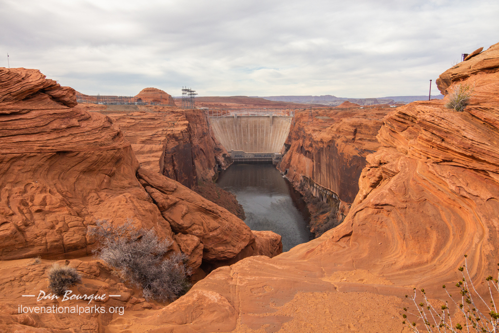
The US 89 bridge across the Colorado River is a great vantage point to see the Glen Canyon Dam
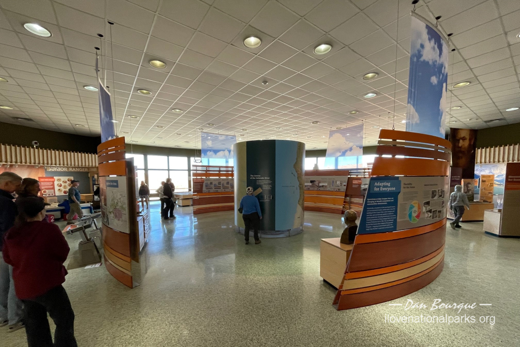
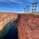
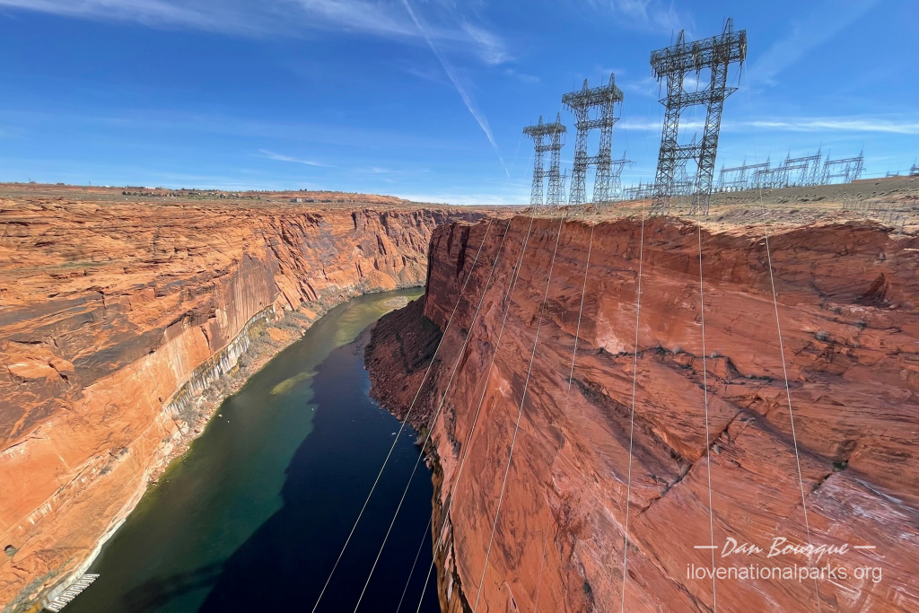
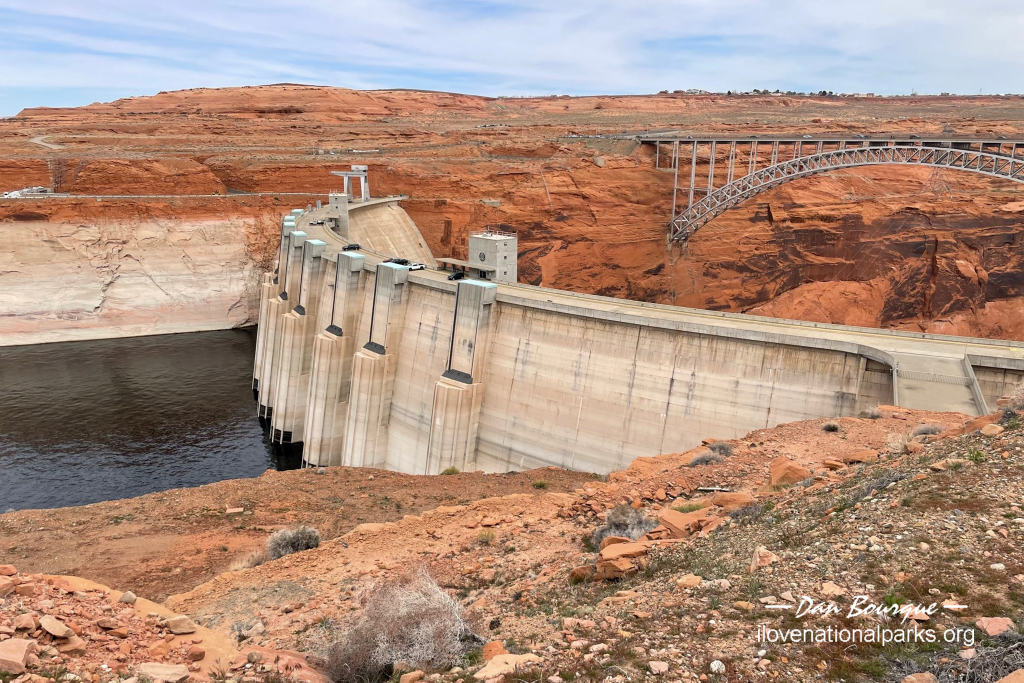
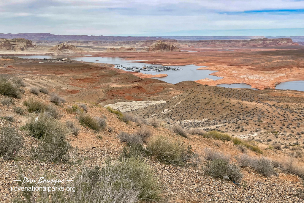
Visiting. If you’re just driving through, even a 30-minute stop at the Carl Hayden Visitors Center near Page, AZ is worthwhile stop. Spend a few minutes in the excellent museum overlooking the dam to get some insight into how the dam was built and some of the cultural and natural features of the park. From the parking lot, you can take the walkway across the US 89 bridge that straddles the Colorado River just south of the dam. From the north side of the bridge, you’ve got a great view of the dam and Lake Powell. From the south side of the bridge, you’ve got a great view of the red cliffs hundreds of feet above the meandering Colorado River. The edges of the bridge are well protected by high chain-link fencing, but there are breaks in the guardrails dividing the walkway from the road, so traffic is the biggest danger for kids and unaware guests. If you’re just driving through on US 89, the Wahweep View overlook is a short drive outside the fee area just north of the dam that gives you a sweeping view of the southern end of the lake and the Wahweep Marina with Navajo Mountain and Tower Butte in the distance.
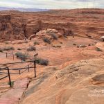
If you have an hour, take US 89 south of Page, AZ to Horseshoe Bend. While technically part of the National Recreation Area, the city of Page manages the parking lot, so it’s a separate fee per car every time you park–don’t worry, it’s worth it! It’s a 3/4 mile hike to the Horseshoe Bend Overlook where you can see a large U of the Colorado River surrounded by red cliffs hundreds of feet high–it’s absolutely sublime! From here, you can hike out along the rim to get more interesting perspectives of the bend (some better than the overlook), but there aren’t any actual trails. If you’ve got young kids, be careful beyond the guardrail area as there’s nothing between you and a several hundred foot fall!
The Hanging Lake Trail offers great views of the red landscape
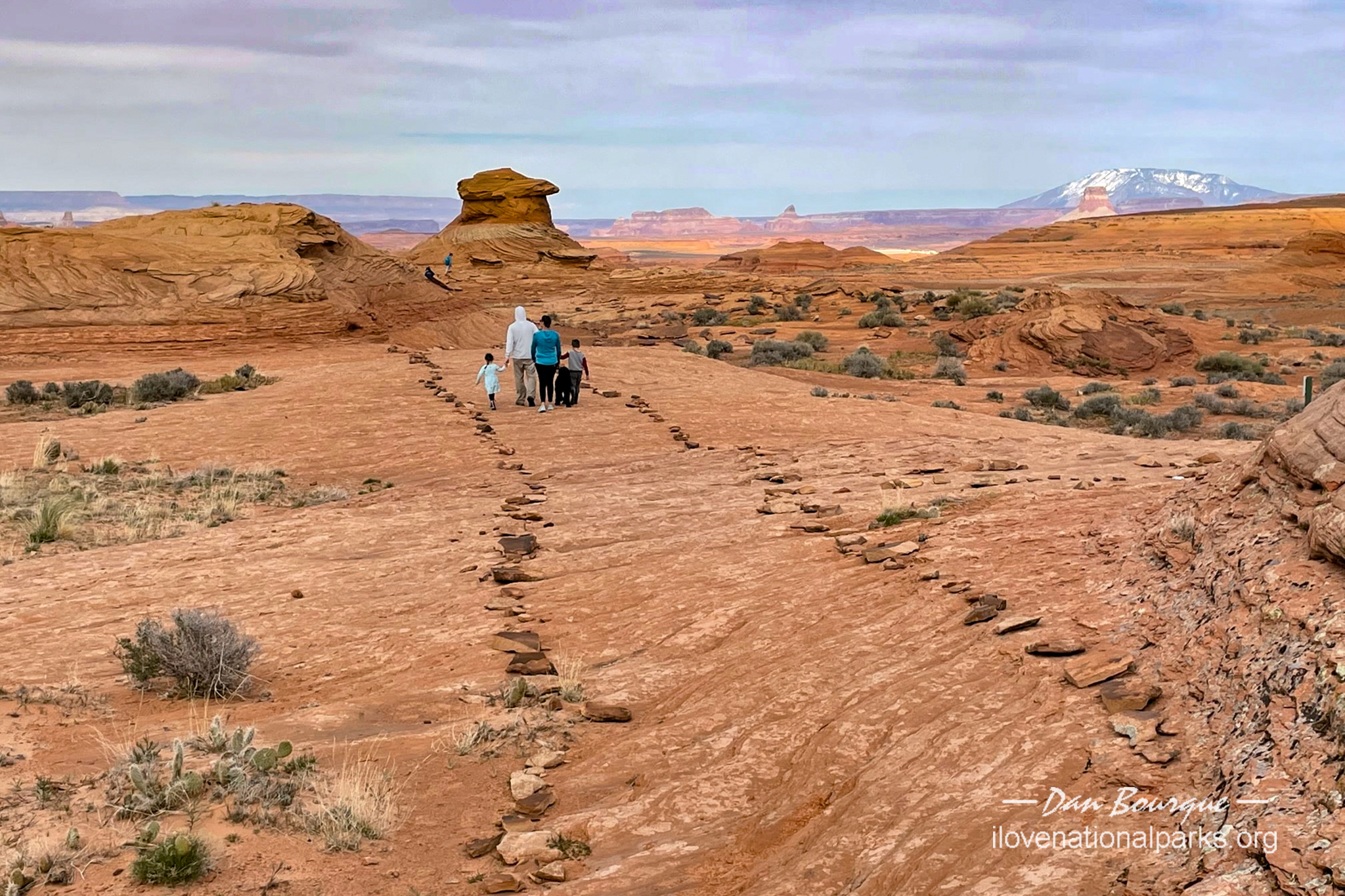
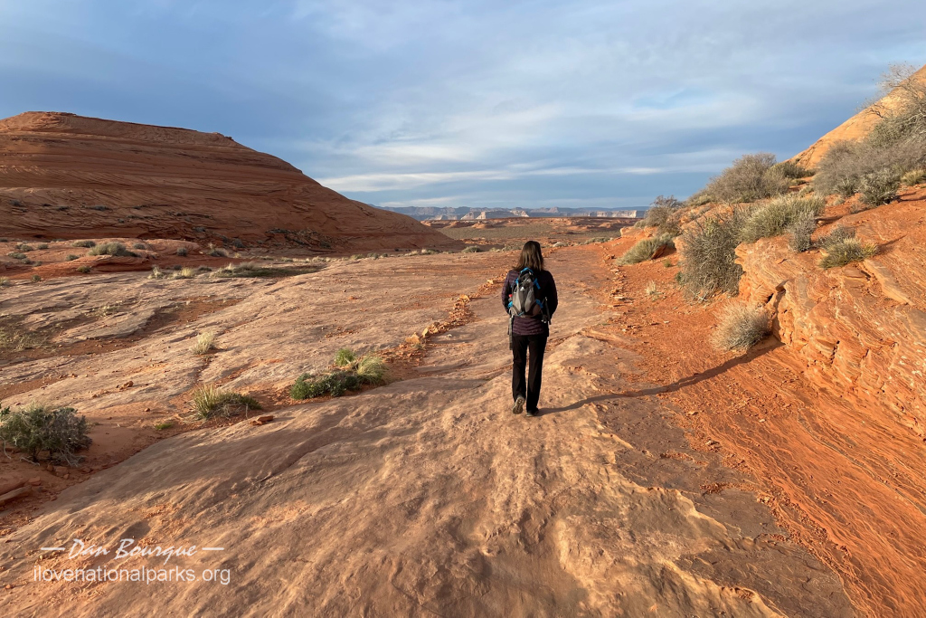
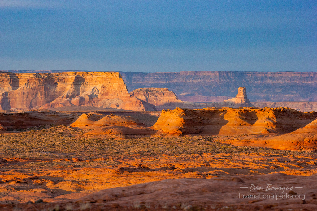
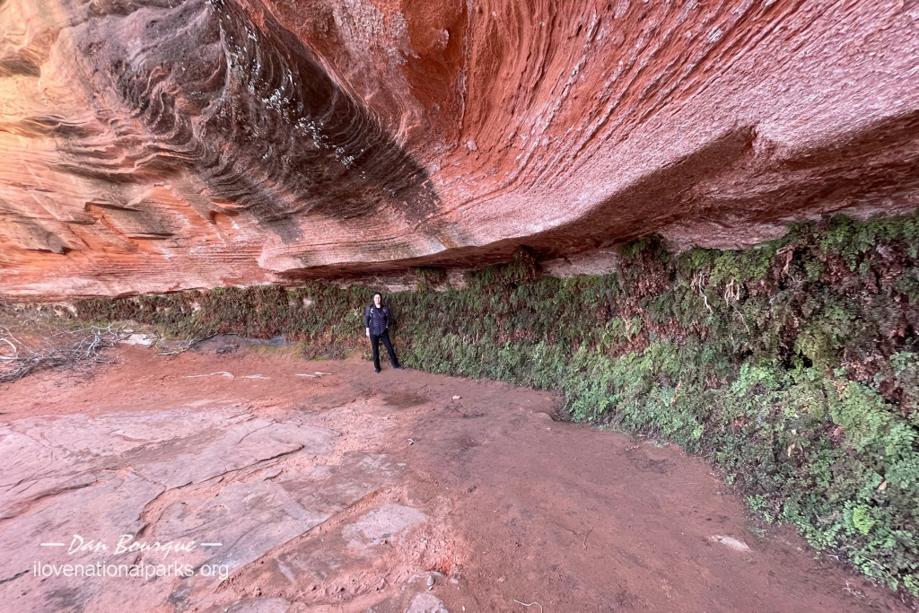
With a little more time, there are several short hikes in the Page area–each is very different, and they’re all outside the fee area. A short but steep trail leads from Page to the Glen Canyon Dam Overlook where you get a good view of the Colorado River with the bridge and dam in the distance. The trail is stair-steep but over uneven rocks, so be careful and use the railing! Another neat hike is the Hanging Garden Trail. This hike is just over a mile out-and-back and leads to an interesting wall of vegetation clinging to the wall under a large rock outcropping. The “garden” is neat, but so are the views of the rock features surrounding Lake Powell you’ll see along the way, especially near sunrise or sunset when the rocks turn red and shadows make the whole scene sublime. A fun trail, especially for kids, is the Beehive Trail, just west of US 89 on the west side of the dam. The trail climbs up and loops around in an area of orange slickrock formations. The striations in the rock are amazing, and the trail is loosely marked with plenty of opportunities for scrambling and exploring. The Rim Trail offers 12 miles of hiking along the top of the Colorado River between the dam and Horseshoe Bend for those looking for a longer trail in the Page area.
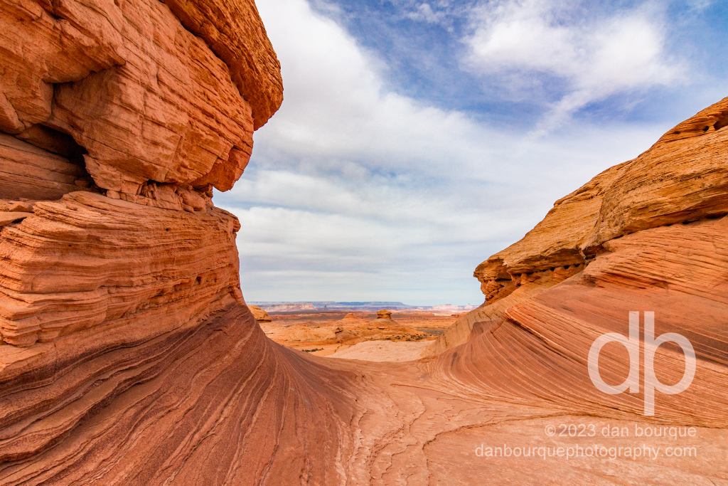
The Beehive Trail is not far from the dam and offers a short hike through slickrock formations
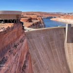
There’s no real reason to go into the fee area unless you’re boating or camping, but if you go in, you can get additional views of the lake from an overlook just north of the dam and from day-use areas around Wahweep. Also, if you’re more interested in engineering and technology, you can sign up for a guided tour of the dam. You’ll want to check on this before you visit as the tours are not always running (e.g., shut down for COVID).
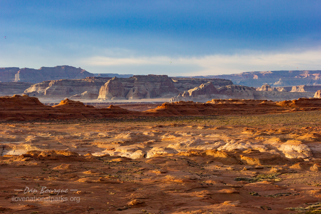
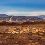
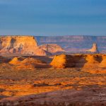
The area on the southern end of the park near Page are the most accessible, but many other areas can be explored by boat, especially when the water is higher, including a trail to Rainbow Bridge National Monument–access is not guaranteed, so check the details on this trail before you go. Additional roads will get you to the Lees Ferry, Bullfrog and Escalante areas of the park which offer hikes of different lengths (mostly longer) to other natural features such as riversides, washes, cliffs, and even hoodoos and arches. Lees Ferry also offers access to the Colorado River for kayaking and even camping at a series of sites upriver between the dam and Lees Ferry.
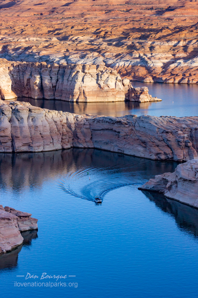
A boat snakes its way through rock formations near the dam that would normally be completely submerged
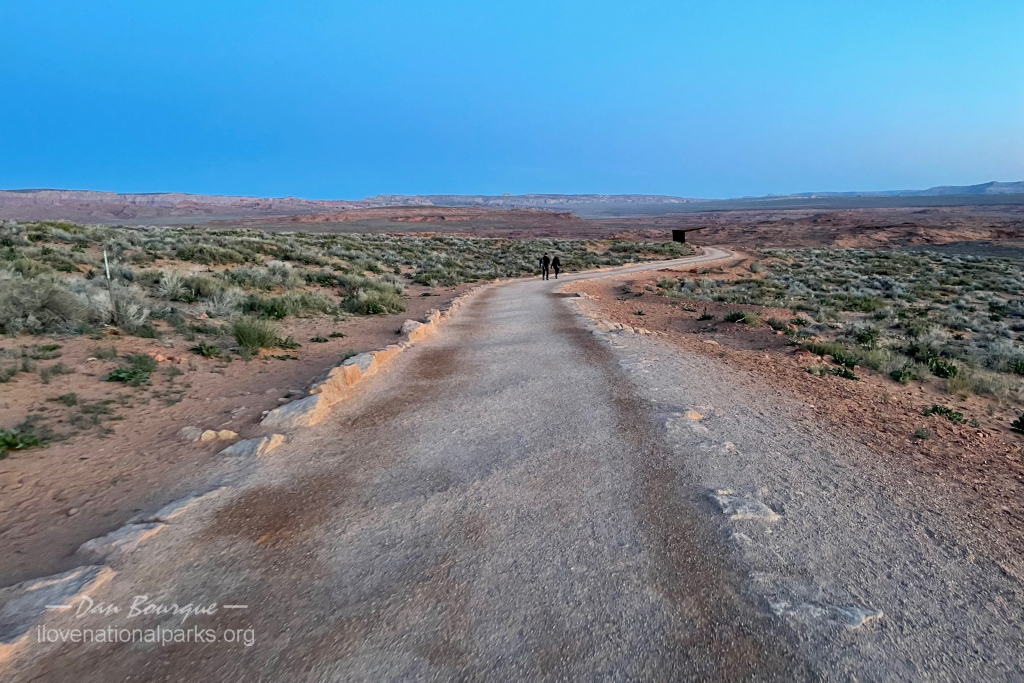
Suggestions. This is the desert, so bring water and sunscreen for a hike of any length. Horseshoe Bend is by far the most crowded area of the park, especially at sunset. It’s not uncommon for the parking lot to fill up, so try to get there around an hour before sunset. Once you hike down, be prepared to jockey with others to get the best views, but there is more room the further away from the guardrail you go… just remember the warning about no railings and drops of hundreds of feet. Also, don’t be surprised to see people doing the stupidest of things on the canyon edge just to get a good selfie. I actually had to move to a different area because my heart kept racing as a girl was tempting fate hanging herself half off the edge just to get a good picture for her social media page. While sunset is the most popular time with the sun setting behind the jutting peninsula in front of you, sunrise is also very beautiful with the sun at your back illuminating the tops of the canyon in front of you. When I went at sunrise, there were maybe 25 cars in the parking lot and only a few dozen people at the overlook–it was far easier to find a space to call your own for several minutes to enjoy the view.
Nearby Towns Page (AZ), Big Water, Bullfrog (UT)
Other Nearby Attractions Rainbow Bridge National Monument, Navajo National Monument, Antelope Canyon
Official NPS Website Glen Canyon National Recreation Area
-
- You don’t even have to venture onto the bridge to get a good look at the dam–this is from the Visitors Center parking lot
-

- The Hayden Visitors Center is home to a great museum focused on the dam, and it includes a huge glass-wall overlook of the dam
-
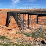
- The US 89 bridge overlooks the dam and is accessible by vehicle or by foot
-
- The US 89 bridge across the Colorado River is a great vantage point to see the Glen Canyon Dam
-
- On the opposite side of the bridge from the dam is this view of the Colorado River
-
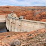
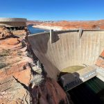
- Here’s a view of the Glen Canyon Dam that’s only available when the water is really low
-
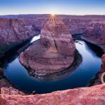
- Horseshoe Bend is one of the icons of the American West that should be on everyone’s bucket list
-
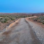
- At sunset, this trail to Horseshoe Bend is covered with people, but at sunrise, the crowd is thin
-
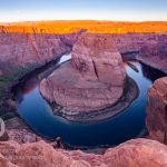
- Sunrise at Horseshoe Bend is different from sunset but still very striking
-
- The path to the scenic overlook of the Glen Canyon Dam is short but treacherous–take advantage of the railing!
-
- The view from the Glen Canyon Dam scenic overlook in Page
-
- The Beehives Trail is roughly marked with rocks on the slickrock
-
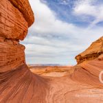
- The Beehive Trail is not far from the dam and offers a short hike through slickrock formations
-
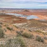
- Wahweep View Drive ends at an overlook that offers panoramic views
-
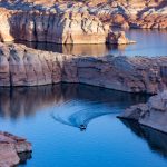
- A boat snakes its way through rock formations near the dam that would normally be completely submerged
-
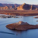
- The pullout and overlook between the entrance station and Wahweep is a good place to see the lake and surrounding areas
-
- This view from near the Wahweep campground shows the low water, normally covering the white area
-
- The Hanging Garden Trail is pretty level and short and offers unique views
-
- The Hanging Lake Trail offers great views of the red landscape
-
- Sunset illuminates the cliffs by the lake as seen from Hanging Garden Trail
-
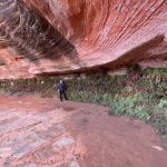
- Hanging Garden Trail is named for this wall of green-covered rocks watered by a seeping overlook
Write Your Own Review
No Comments Yet