 Most people visiting Curecanti National Recreation Area do so driving through on US 50 or boating on Blue Mesa Reservoir. If this is all you do, you would miss the real beauty of Curecanti which is off the beaten path but still readily accessible for those willing to take the back roads.
Visitor Rating (write your own review below)
Get off the beaten path
ILNP Park Review
Our Visit. We visited Curecanti in July while taking the back way between Glenwood Springs (I-70 corridor) and South Fork, Colorado (eastern San Juan Mountains)
Our Weather Upper 80s, sunny, and a bit windy
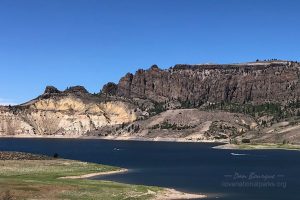
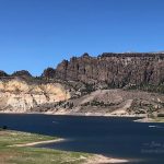
This is as good as the view gets from US 50, looking across Blue Mesa Reservoir to the Dillon Pinnacles
About the Park. Curecanti National Recreation Area was established in 1965 to manage three reservoirs on the Colorado River: Blue Mesa, Morrow Point, and Crystal Reservoirs. It also protects the eastern end of the dramatic Black Canyon of the Gunnison.
Visiting. Curecanti is easy to pass through as it sits astride one of the major highways connecting eastern and western Colorado, US 50. It’s free to drive through the park, and if this is all you do, you’ll get a good feel for Blue Mesa Reservoir (the highway parallels and cuts across it) and the attractive brown rock formations including the dramatic Dillon Pinnacles that line its banks. If you’re into boating, Blue Mesa is a beautiful place to do so, though I won’t cover that here.
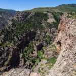
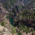
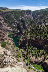 If you’ve got an extra hour or two, you can really experience Curecanti’s beauty by exploring the far more beautiful western side of the park via CO 92 which meets US 50 at the Blue Mesa Dam. The “must see” area of the park is Pioneer Point which overlooks the Curecanti Needle and the eastern end of the Black Canyon of the Gunnison. The canyon is not as steep here as it is in the adjacent National Park, but it’s still breathtaking, especially with the dark teal waters of Morrow Point Reservoir at the base. 45 minutes will allow you to drive the steep and winding road to from US 50 to Pioneer Point, explore at least one of the overlooks (they branch in both directions–if you have to choose one, go left), and return to US 50. If you have another 45 minutes, continue further up US 92 to Hermits Roost, another overlook where you’ll see a slightly less dramatic view of the canyon and reservoir, but you’ll be treated to a backdrop of the San Juan Mountains to the south.
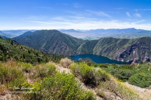
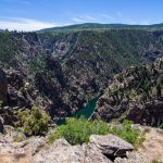
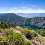
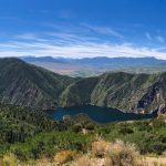
This is the view from Hermits Roost along CO 92–it offers great views of Morrow Point Reservoir and the distant San Juan Mountains
With more time, consider a hike. There aren’t many trails in Curecanti (7), and most are moderate to strenuous due to elevation changes. For an easy, family friendly hike to get away from the heat of the rocky terrain near Blue Mesa, the Neversink Trail offers a walk along the wooded banks of the Colorado River on the eastern end of the park. When I’m next in Curecanti, I plan to stop by the Railroad Exhibits in Cimarron and hike the moderate Mesa Creek Trail down to Morrow Point Reservoir. Other moderate options include the Dillon Pinnacles Trail on the north bank of Blue Mesa and the Crystal Creek Trail on the eastern side of the park. For those looking for an adventure with lots of elevation change in a short distance, the Curecanti Creek Trail descends down into the base Black Canyon from Pioneer Point and promises spectacular views of the canyon and the Curecanti Needle.
Suggestions. If you’re just driving through, do everything you can to spare the 45 minutes to detour onto CO 92 to at least Pioneer Point. If you visit in the summer, prepare for dry heat and bring plenty of water if you’re hiking. Summer is also “construction season” in Colorado, and this stretch of US 50 is notorious for being under continual construction. On our trip, it took us 40 minutes to go 5 miles because traffic was constricted to one lane across the Blue Mesa Reservoir Bridge.
Nearby Towns Gunnison, Montrose (Colorado)
Other Nearby Attractions Black Canyon of the Gunnison NP
Official Website Curecanti National Recreation Area
- The Blue Mesa Reservoir is the heart of Curecanti NRA, but it’s far from the most beautiful part of the park–this is the view while driving across the park via US 50
- This is as good as the view gets from US 50, looking across Blue Mesa Reservoir to the Dillon Pinnacles
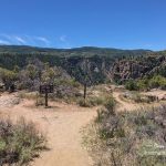
- The trail to the overlooks at Pioneer Point starts here. To the left is a good view down the canyon to the east; to the right is a good view of Morrow Point Reservoir and the formations inside the canyon.
- The triangular formation in the left-center of this image is the Curecanti Needle, a large formation on the south wall of the canyon
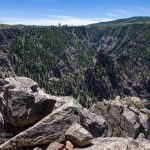
- There are rocks aplenty at Pioneer Point including vistas of formations like the Curecanti Needle and great foreground rocks for photogenic compositions
- Looking west from Pioneer Point. The trail along the bottom can be seen just over the rock at the lower left, and the west end of the overlook trail is on the promontory on the upper right.
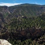
- Panoramic shot from the westernmost overlook at Pioneer Point.
- This is the view from Hermits Roost along CO 92–it offers great views of Morrow Point Reservoir and the distant San Juan Mountains
- Panoramic shot of the view from Hermits Roost on CO 92 on the northwest side of the park. Morrow Point Reservoir is below and the San Juan Mountains are in the distance.
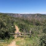
- The beginning of the Crystal Creek Trail which ventures to the edge of the canyon seen in the background
Write Your Own Review

No Comments Yet