
 Canyonlands National Park, Utah, was established in 1964 and is home to thousands of red rock canyons,spires and arches twisted together into a bizarre landscape that is beautiful and yet otherworldly.
Visitor Rating (write your own review below)
Just as neat as Arches
ILNP Rating![]()
Scenery![]()
Uniqueness![]()
Wildlife![]()
Diversity![]()
ILNP Park Review
In a Word. “Alien”
“You answer us with awesome deeds of righteousness, O God our Savior, the hope of all the ends of the earth and the farthest seas, who formed the mountains by your power.” -Psalms 65:5-6
 Our Visit. We visited Canyonlands in June during a three-day trip to Moab, Utah which also included a visit to Arches National Park.
Our Weather. Hot, sunny and dry with high 90s for temperatures.
Overall Impression. Canyonlands is truly a wonder to behold. It’s really three parks in one with each having its own distinct character, but everywhere you look are dazzling displays of red and white rock. In some areas, you gaze from high vistas at a seemingly endless maze of canyons, in others you view rock formations through the eye of an arch, in still others, you look up from the canyon floor at a forest of towering red and white spires against a deep blue sky. The amazing landscape of Canyonlands is matched only by its remoteness.
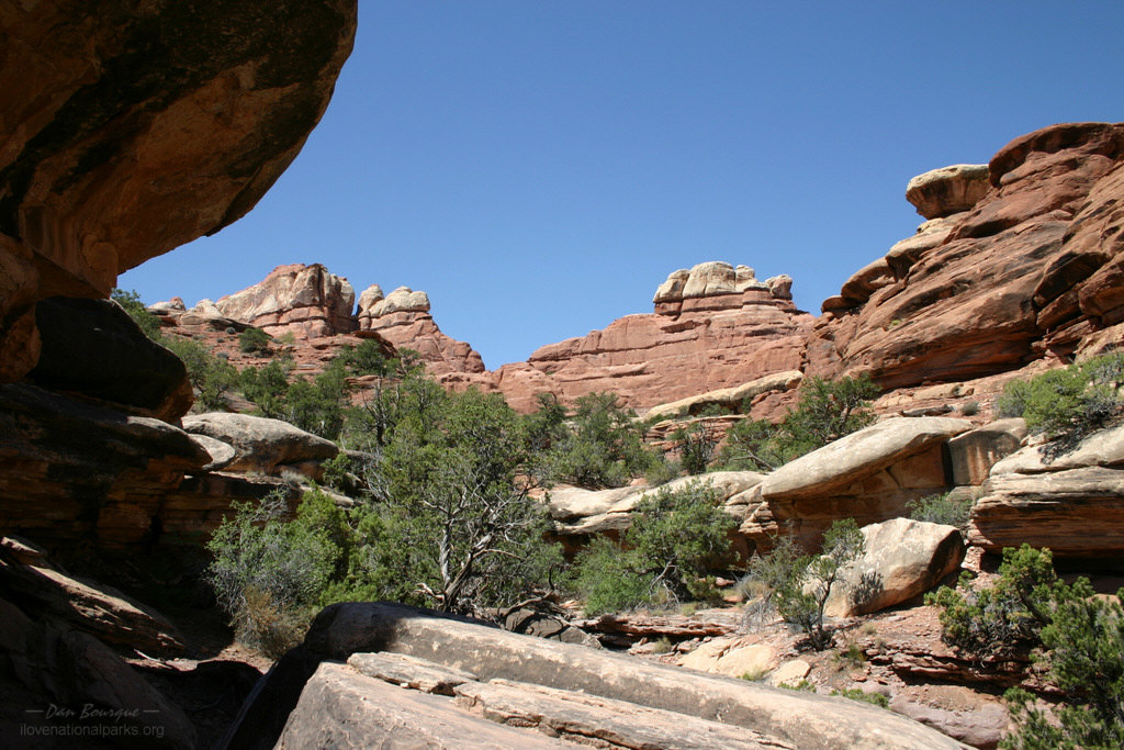
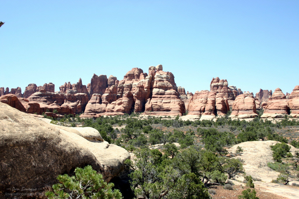
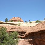
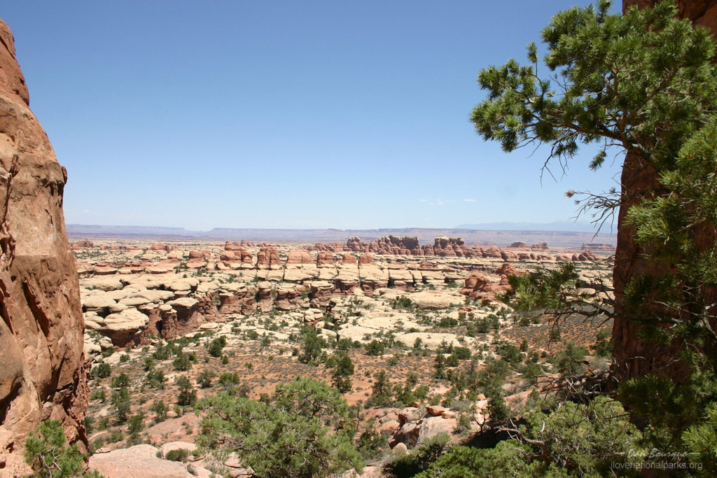
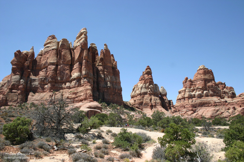
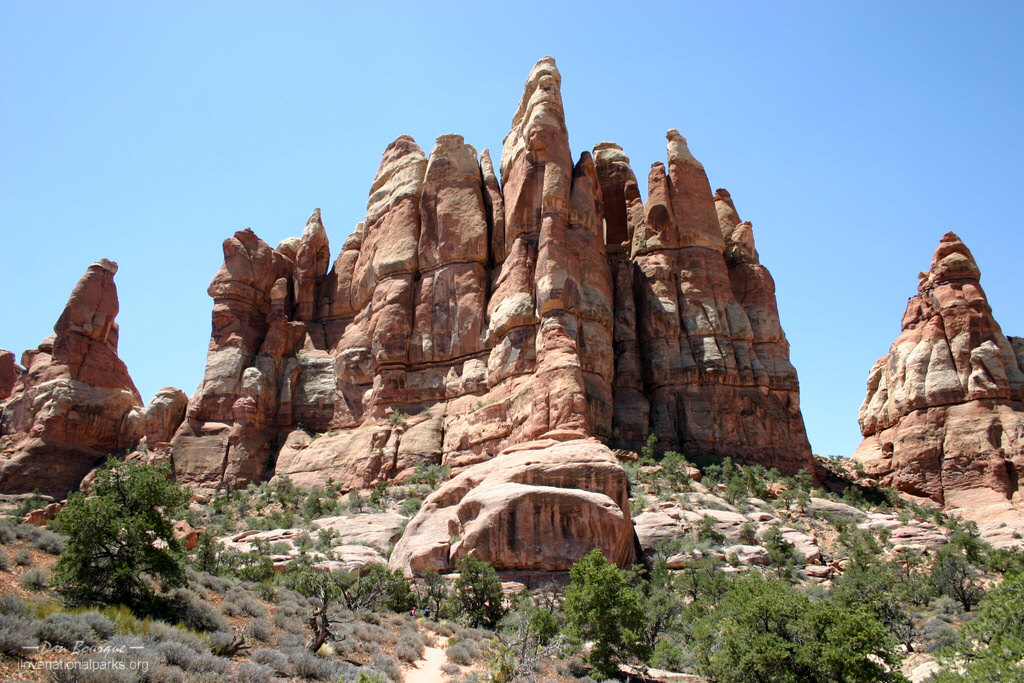
Favorite Spot. Looking up at the Needles from Chesler Park Trail
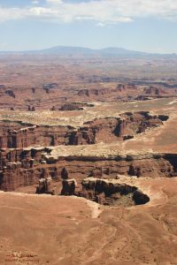
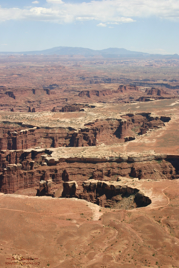
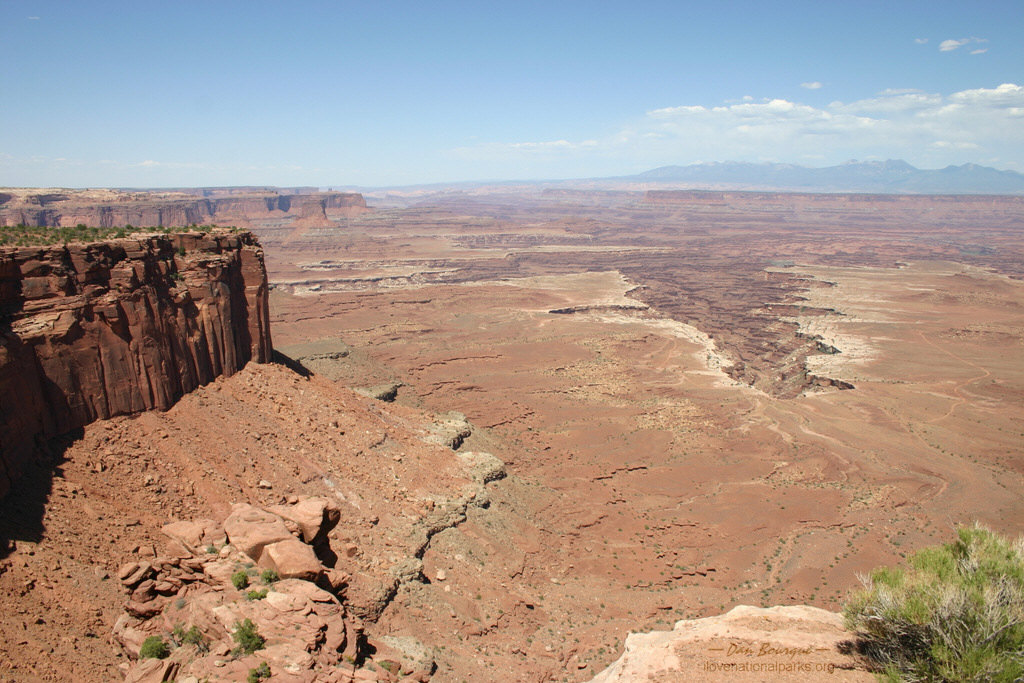
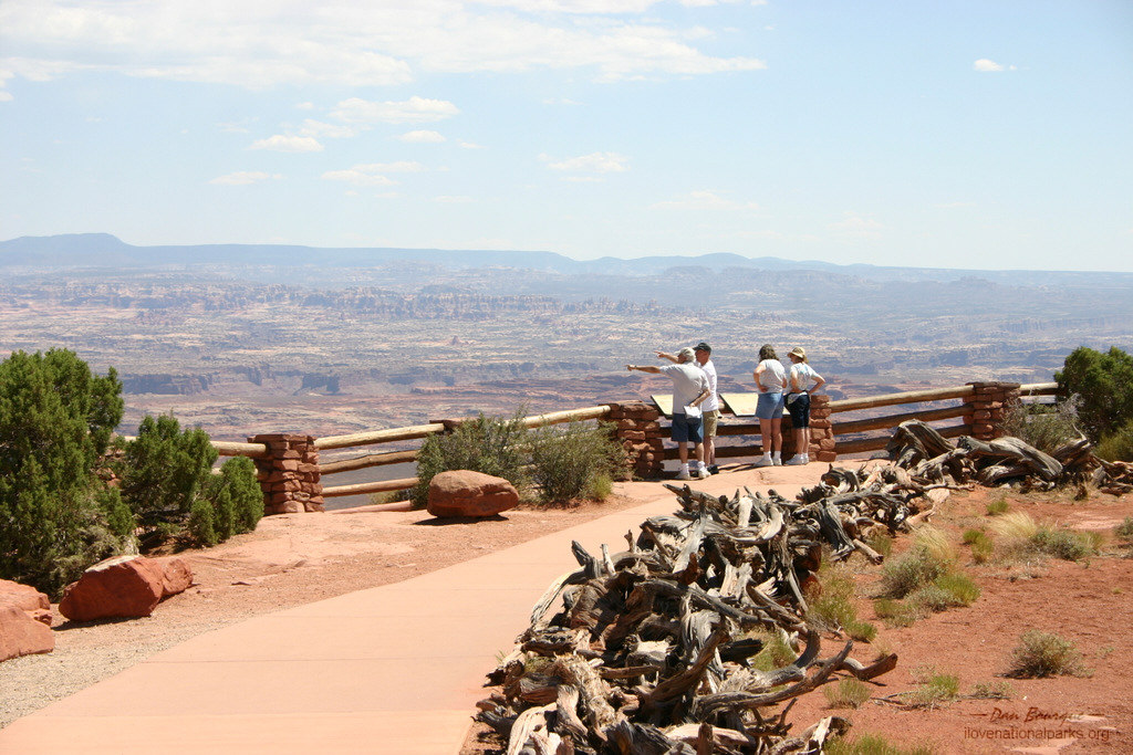
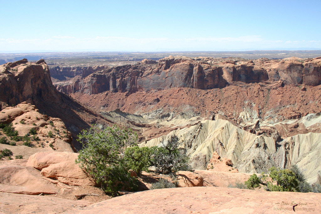
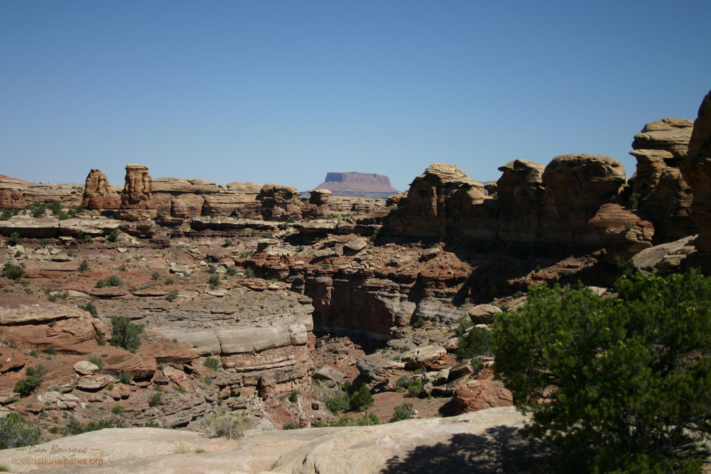
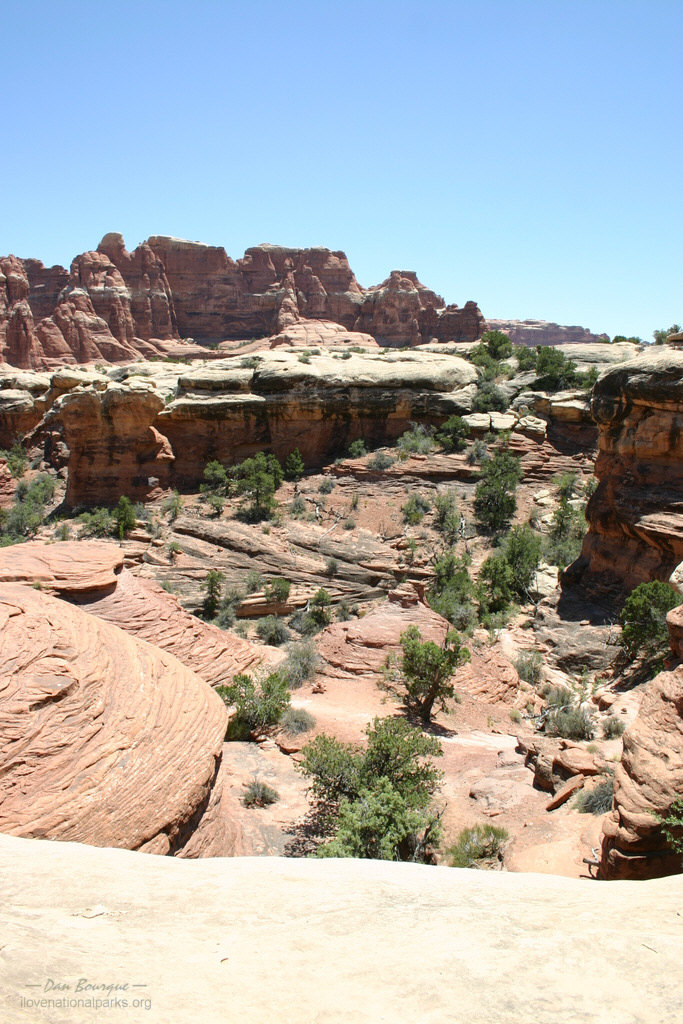
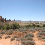
Amazing array of canyons from Grand View Overlook in the Island District (June)
Minimum Time Required. About 2 hours. For any visit, you need to understand a few things about Canyonlands. First, it is more like three parks in one–the Colorado and Green Rivers divide the park into three districts, the northern Island in the Sky, the southeastern Needles District and The Maze to the southwest. There are no bridges across the rivers, so a drive between sections takes about 3 hours. Second, there are very few paved roads. In fact, the Maze has no paved roads at all and is normally accessed via 4-wheel drive vehicles on rough dirt roads. While a driving tour through the park is still rewarding, many of the wonders of Canyonlands can only be accessed by 4-wheel drive, mountain bike, raft or just plain hiking.
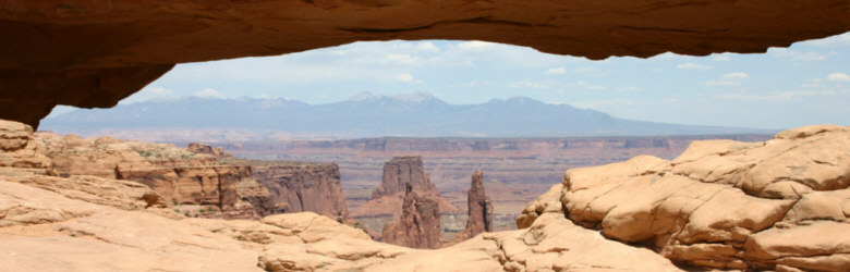
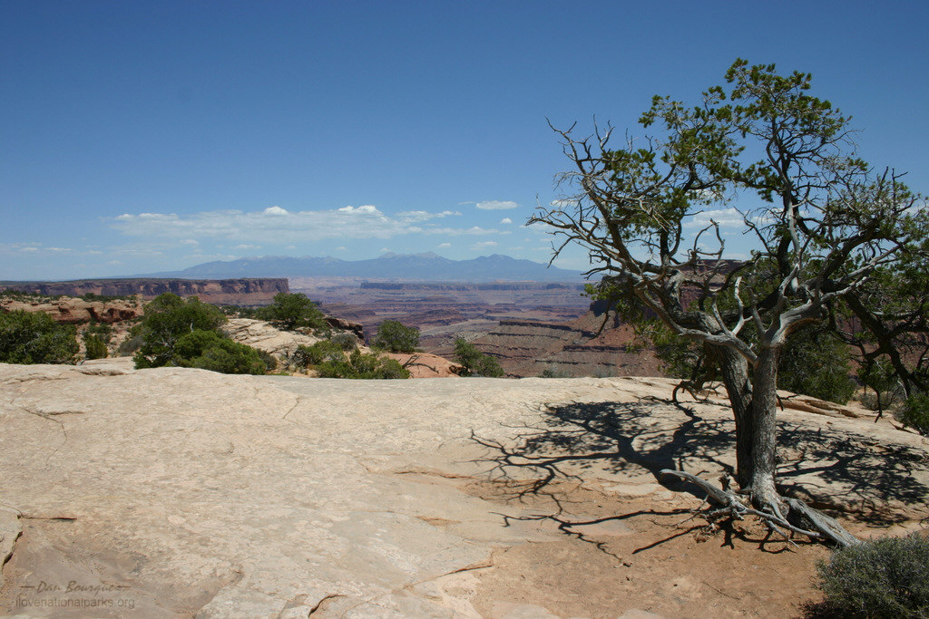
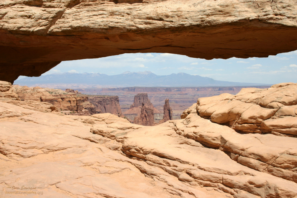
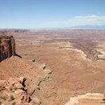
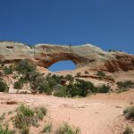
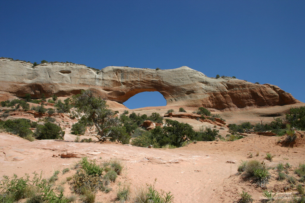
If you only have a couple hours, visit the Island in the Sky which refers to the high mesa upon which the road lies. This section is closest to the main highways, offers the most paved roads, and much of its fantastic scenery can be accessed via overlooks along the road or brief hikes. The first good view from Island in the Sky is of Shafer Canyon directly across from the Visitor Center. The next “must see” in this section is Mesa Arch which is a favorite of photographers and can be accessed via a short hike. Be prepared for combat photography as this is probably the most popular spot in the park. Just south of Mesa Arch, the road splits. If you don’t have time to travel both, take the southern road (to the left) to some magnificent overlooks including Buck Canyon Overlook and Grand View Overlook. If time permits, the western road leads to a steep but short hike to viewpoints of Upheaval Dome a gigantic round canyonlike depression.

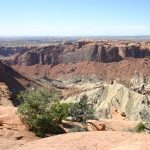
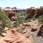
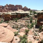
Big Spring Canyon formations with the Needles in the background (June)
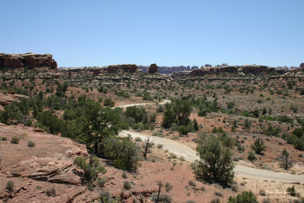
A Longer Visit. On a longer visit, you should still spend some time in Island in the Sky as described above and perhaps even take a longer hike around Upheaval Dome, but I recommend making the trek down to the Needles District. The drive to Needles is amazing in itself and passes the very accessible Wilson Arch along US 191 and then winds through the stunning red canyons of Indian Creek along Utah 211, part of Bears Ears National Monument. Once in Canyonlands, make a quick stop at the Visitor Center to fill up on water and chat with a Park Ranger. The paved roads can all be traveled in under an hour and will offer views of the aptly named Wooden Shoe Arch, the squatty formations of Big Spring Canyon and some distant views of the red and white needles the district is named. To get to the needles, though, you’ll need to do some hiking. The closest trail head is from Elephant Hill Road which can be accessed in a normal passenger vehicle to the trail head parking lot before it gets technical.

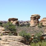
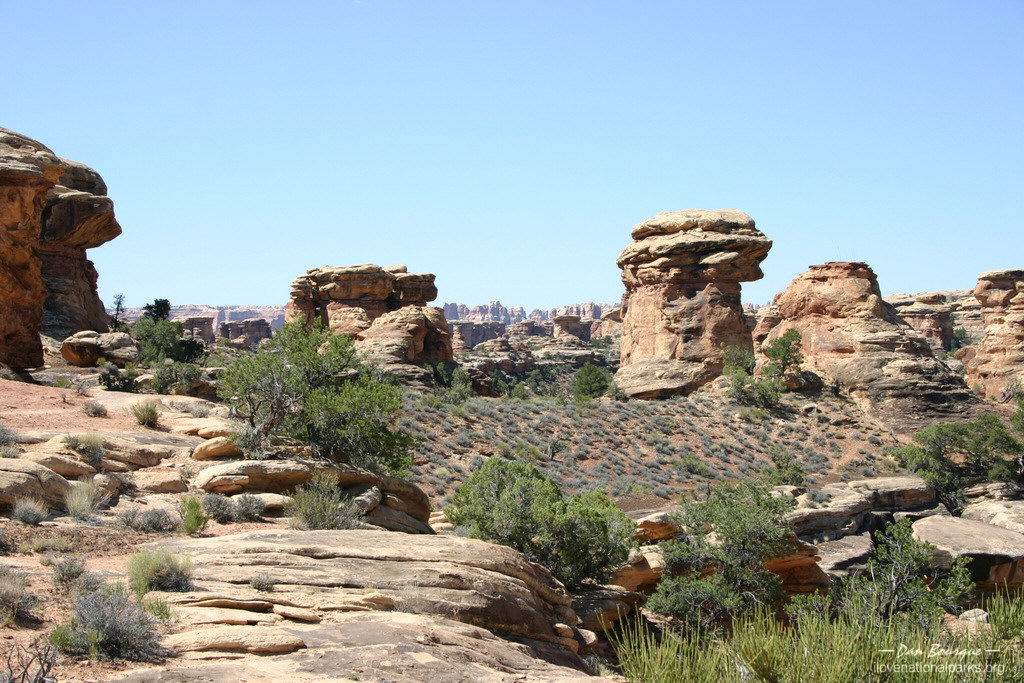
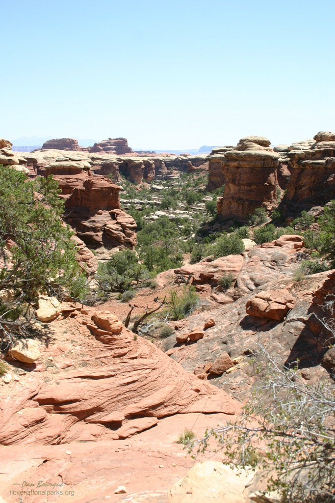
The Needles along Chesler Park Trail (June)
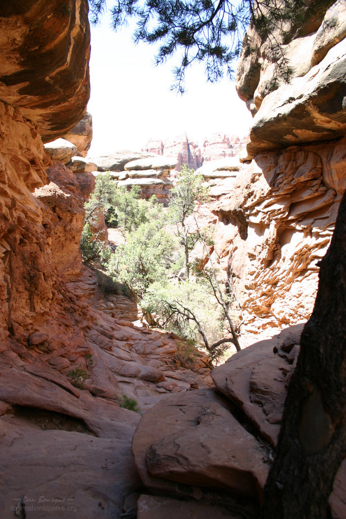
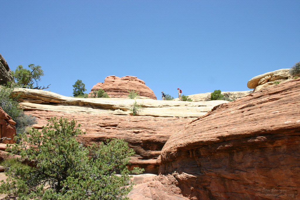
From the parking lot, the Chesler Park Trail ascends to the base of Elephant Hill and travels along the slickrock, through narrow slots in the sandstone, down into Elephant Canyon and finally to the base of some prominent needles near Chesler Park. A round trip is 6 miles, though numerous trails to places like Devils Kitchen and Druid Arch will take you many miles further into the needles. Even if you’re not up a full 6 miles, a 1-mile excursion on the trail (2-mile round trip) offers a great view of the Needles from an outcropping. You will know you’re there because you traverse through a narrow crevice and onto the rock promontory before the trail continues through the flat area below. Another .8 miles takes you to the bottom of Elephant Canyon, and another .6 takes you to the base of the needles. The last .2 climbs up into the needles offering great views before dropping down into Chesler Park. This was one of the best hikes I’ve ever taken, and I wish I’d had the time to go even farther.
 Another popular hike is the 5-mile (10-mile round trip) hike to Confluence Overlook which offers Grand Canyon-like views of the canyons where the Colorado and Green Rivers meet. The Needles District is also home to some human history which you can see by taking the short hike to the Roadside Ruin near the entrance. For those who really like to explore in 4-wheel drive vehicles, The Maze offers plenty of great scenery and no crowds. Other websites which cater to the 4-wheel drive community will offer much more information on this aspect of Canyonlands.

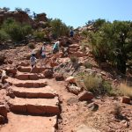
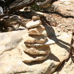
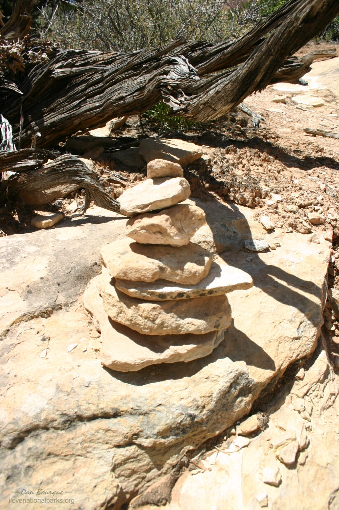
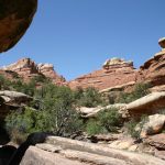
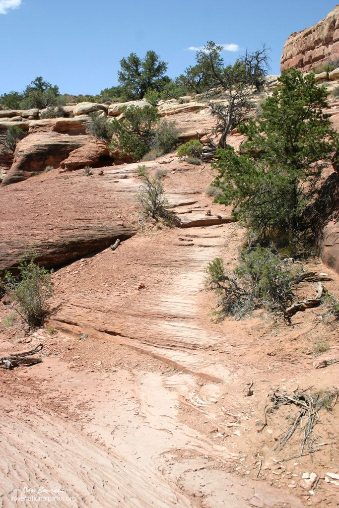
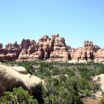
Primitive slickrock trail to Chesler Park, note the small piles of rocks marking the trail (June)
Suggestions. This is the high desert. Most people who have a choice visit in the Spring or Fall when temperatures are cooler, but even the 90s of June were tolerable with plenty of drinking water, a hat and some sunscreen. If you’re going for a long hike, take as much water as you can carry. I hydrated on the drive in, guzzled a half-liter before hitting the trail, and still drained my 2-liter Camelback a mile before concluding my 6-mile hike. Because of the park’s remoteness, especially in the Needles and the Maze districts, you’ll need to bring enough food and water to last the day, though the Visitor Center offers a place to fill up on water.
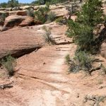
When hiking, be sure to look for the trail markers! Many of the trails are primitive and on top of slickrock, so at several points I found myself off the trail accidentally and looking for the markers. The piled-rock trail markers are everywhere along the trail, so don’t go too far without seeing one. At every point where I found myself wondering, “now where is the trail,” I was quickly able to scan around and find a trail marker to lead me back.
Nearby Towns Moab, Monticello (Utah)
Other Nearby Attractions Arches National Park, Bears Ears National Monument
Official NPS Website Canyonlands NP
-
- View of Shafer Canyon near the Visitor Center in the Island District (June)
-
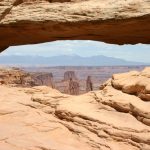
- Mesa Arch, with its eye-level view of the canyons beyond, is the most popular spot in the park (June)
-
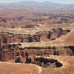
- Amazing array of canyons from Grand View Overlook in the Island District (June)
-
- Stunning vistas is the best way to describe the Island District. This is Candlestick Tower Overlook. Don’t worry, it’s not as big of a drop as it looks (June)

-
- More canyons viewed from Buck Canyon Overlook (June)
-
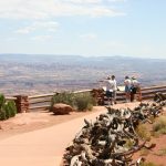
- Grand View Overlook is accessed via a short trail, though the view alongside the parking lot is nothing to be ashamed of as seen here (June)
-
- Short but steep trail to Upheaval Dome overlook in the Island District (June)
-
- Scientists disagree on what formed Upheaval Dome, but it’s neat to see such a large natural circular depression (June)
-
- Aptly named Whale Rock as seen from the trail to Upheaval Dome (June)
-
- Canyonlands trails are marked with markers like this one. If you look around and don’t see one, you’re probably not on the trail! (June)
-
- Wilson Arch is off of US 191 between Moab and the Needles District. It is a nice arch and worth a stop (June)
-
- The drive into Needles through Indian Creek Canyon is spectacular, though seeing cows in the foreground reminds you that you’re not in the National Park just yet (June)
-
- Just in case you were wondering why it’s called “Wooden Shoe Arch”. . . (June)
-
- Looking north toward the Island in the Sky from Big Spring Canyon in the Needles District. It’s only a few miles away, but it’s a 3-hour drive by car (June)
-
- Pothole Point offers a short loop trail with views of the Needles in the distance. The holes in the rock fill with water after it rains (June)
-
- Big Spring Canyon formations with the Needles in the background (June)
-
- The first part of Elephant Hill Road is dirt but is easily traversed by passenger car (June)
-
- Elephant Hill as seen from the Chesler Park Trail (June)
-
- Primitive slickrock trail to Chesler Park, note the small piles of rocks marking the trail (June)
-
- One of the many distinct small canyons near Elephant Hill (June)
-
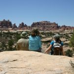
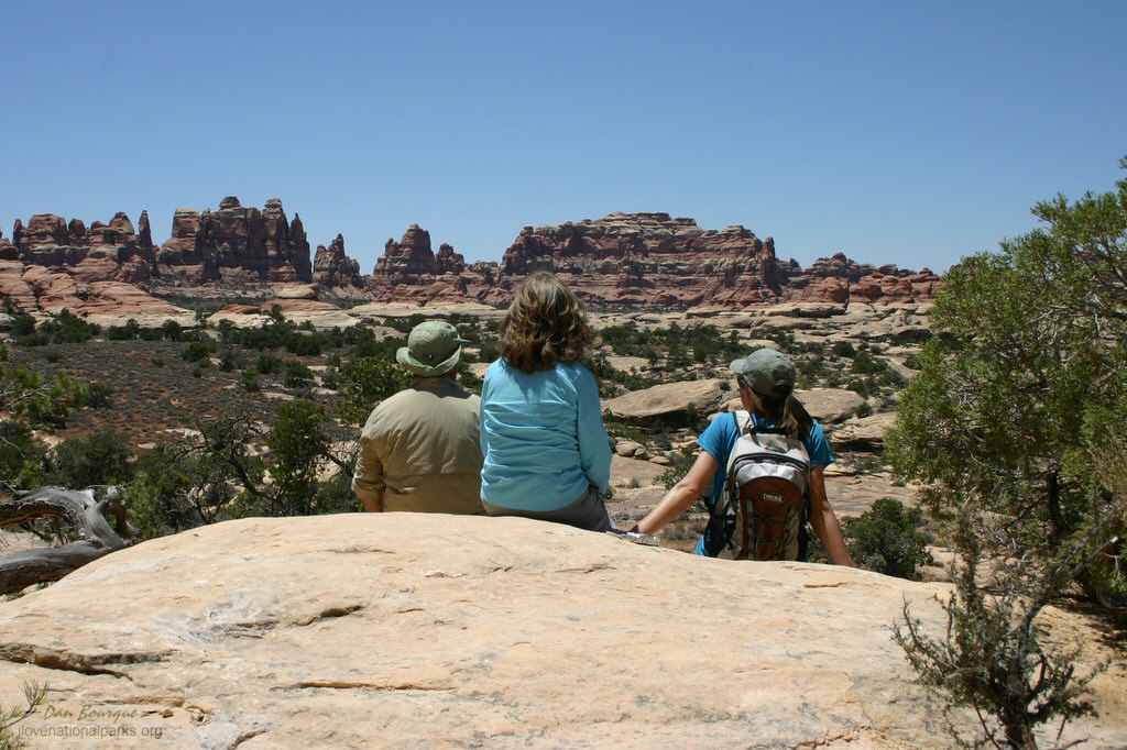
- Family enjoying the view of the Needles from the Chesler Park Trail. This outcropping is about one-mile from the parking lot and is a good turn-around point if you don’t want to hike the full trail (June)
-
- Good view of the Needles from the outcropping described previously (June)
-
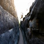
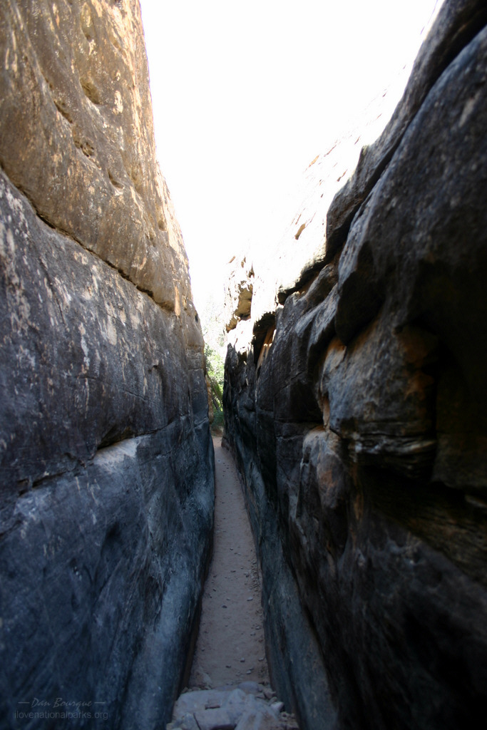
- The Chesler Park Trail gets a little narrow at places where it cuts through large cracks in the sandstone (June)
-
- The narrow squeeze opens into a beautiful little slot canyon (June)
-
- Chesler Park Trail winds down into Elephant Canyon and then switchbacks up the far side (June)
-
- Looking down Elephant Canyon from Chesler Park Trail (June)
-
- The last part of Chesler Park Trail climbs into the needles offering great views of Elephant Canyon (June)
-
- The Needles along Chesler Park Trail (June)
-
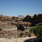
- Chesler Park Trail runs past the base of this prominent grouping of large needles (June)
-
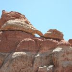
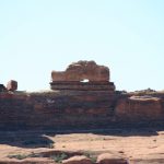
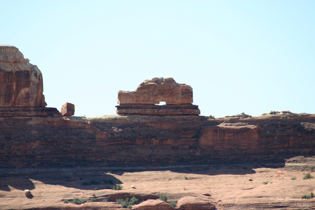
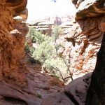
- Small arch on the backside of the large formation above (June)

-
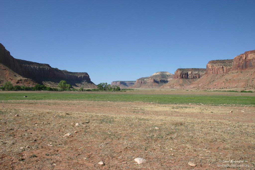
- Chesler Park is a grassy area surrounded by needles on all sides (June)

Write Your Own Review
No Comments Yet