
 Shenandoah National Park, Virginia, protects a long, narrow strip of the Blue Ridge Mountains. Unlike most parks, Shenandoah’s land was mostly settled, and a significant portion of it was deforested before the state of Virginia began to piece the park together. The park was established in December 1935, and since then, most of the forest has returned, and there are few signs of earlier inhabitation by settlers.
Visitor Rating (write your own review below)
ILNP Rating![]()
Scenery![]()
Uniqueness![]()
Wildlife![]()
Diversity![]()
ILNP Park Review
In a Word. “Lush”
“For the Lord your God is bringing you into a good land; a land with streams and pools of water, with springs flowing in the valleys and hills.” -Deuteronomy 8:7
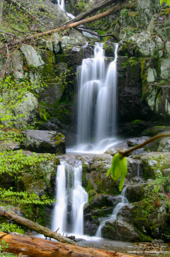
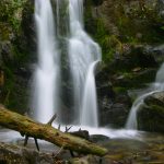
The hike to Lower Doyles River Falls adds another 1/2 mile and the toughest terrain to the hike, but the falls are nice (May)
Our Visit. I visited Shenandoah twice in one year, once in early May and once in June while on separate trips to Virginia. In May, I took a half-day excursion into the southern part of the park where I split my time between driving on Skyline Drive and hiking one of many trails in the narrow but deceptively long park. In June, I entered the north half of the park about an hour before sunset and drove Skyline Drive between Front Royal and just south of Thornton Gap.
Our Weather. The weather in May was cool (low 60s) and overcast with a little rain (typical for spring in this park). The weather in June was a little warmer (upper 70s) but the skies were full of scattered thunderstorms.
Overall Impression. Shenandoah is a beautiful and peaceful place not far from eastern farmland and urban sprawl. Despite its past, full of settlements and logging, Shenandoah’s forests feel pristine. While the mountains, forests and streams are beautiful any time of the year, Shenandoah’s beauty is mostly seen in the fall when the hillsides turn red and orange. Most visitors only see the park from Skyline Drive which runs right up the middle along the ridge line. To really experience Shenandoah, though, you have to park the car and take a little excursion along a trail (including the Appalachian Trail which runs the length of the park).
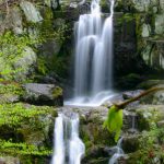
Favorite Spot. the Upper Doyles River Falls
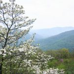
One of many overlooks from Skyline Drive. This is the Ivy Creek overlook (May)
Minimum Time Required. About 2 hours to 1/2 a day. Whether coming in from the north or south, this is enough time to drive through at least 1/3 of the park, experience several overlooks and take a short hike.
A Longer Visit. 1-2 full days is probably plenty to see the park. Unless you’re backpacking through the park on the Appalachian Trail (a very popular thing to do), you’ll be able to drive all of Skyline Drive and take a couple of day hikes to waterfalls or peaks in a day or two. Decide up-front what you want to do. If your desire is to drive the entire Skyline Drive through the park and see the sights from the roadside overlooks, you’ll need most of the day to do it. The speed limit is 35 MPH throughout the park, and the road winds its way along the ridge making the drive much longer than it appears on a map.
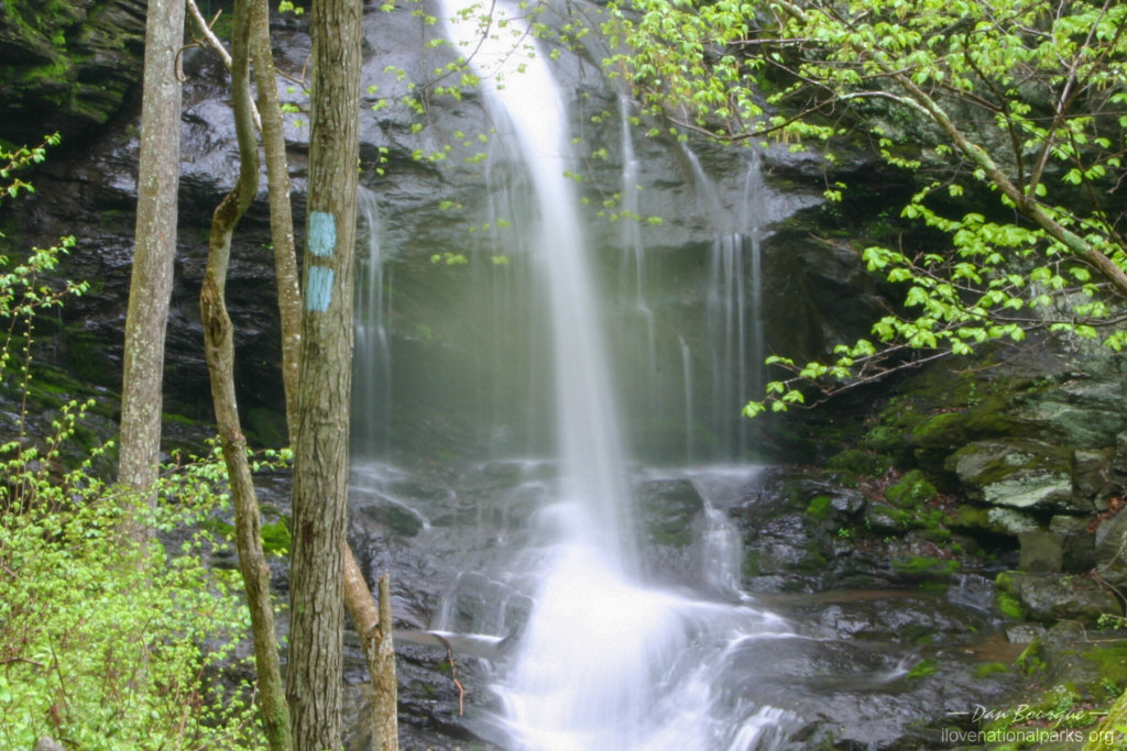
Upper Doyles River Falls (May)
If you’re starting and ending at the same point in the park (i.e. you’re not driving through to get somewhere), I recommend sticking to one half of the park and exploring trails along the way. You can pick up trail maps at the visitors centers or the entrance stations. While not very detailed, they give good descriptions of the trails including the distance and time needed to complete each hike. I visited the southern half of Shenandoah on a cloudy day, so I looked at the descriptions and chose a trail that would take me to one of the park’s nine waterfalls. I started from Rockfish Gap near Waynesboro. I spent most of the morning meandering up Skyline Drive and pulling off at every overlook. I didn’t have to fight any crowds on this spring Tuesday, so it was easy to pull off, take a picture and pull right back on. There are overlooks everywhere, and from what I saw, there was very little to differentiate one from another. They all overlooked mountains and trees, so don’t worry if you miss one. My favorite overlook in the south was the Moormans River Overlook because the scenery seemed a little “deeper” with fewer signs of civilization, and there was a little bit of water to add interest. I then spent two hours hiking down the Doyles River Trail from the parking lot near Big Run Overlook.
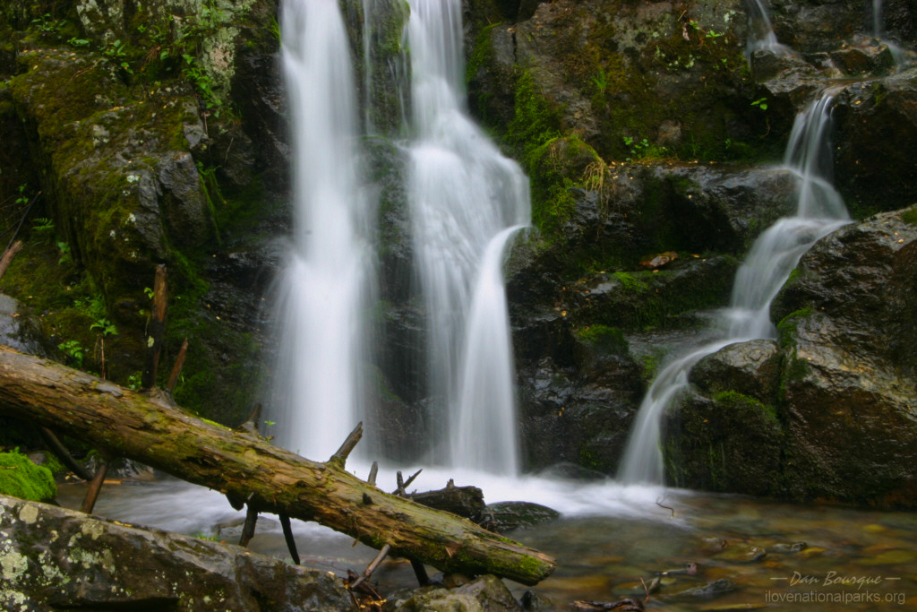
The trail guide says to budget three hours for this trail, but I made it round trip in two including time for photos. While only three miles round-trip, this trail descends, and then ascends, 1,000 feet of elevation. It’s worth it if you’re in decent shape, just keep in mind that you’re not only walking three miles but climbing the equivalent of the Empire State Building as well. The trail is well marked, but it includes several small stream crossings. You can use rocks to avoid getting your feet wet if you’re careful. The trail to the Upper Doyles River Falls is pretty straightforward, but the 1/2 mile between the upper and lower falls can be a bit slippery and difficult when wet. Ever though the lower falls is taller, I found the upper falls to be the more picturesque of the two, so don’t feel like you’re missing too much if you only get to the upper falls. I got rained on, and then I was sweating profusely on the way back up, so the rest of my day was spent drying off. I exited the park at Swift Run Gap to avoid the long drive back along Skyline Drive.
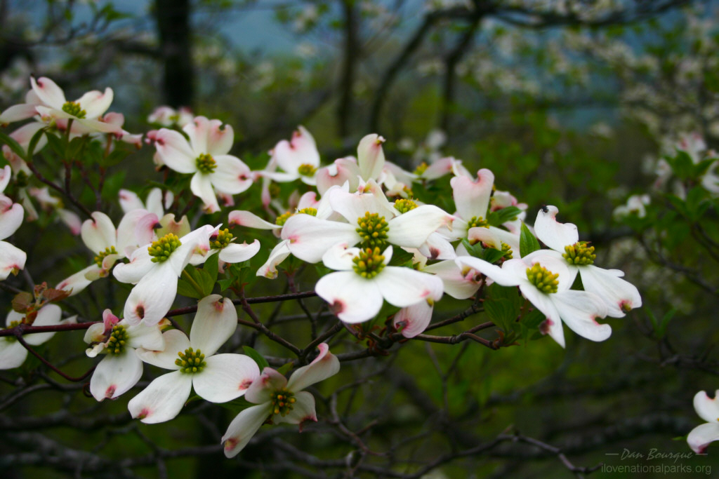
Flowers on a dogwood tree. These trees bloom in April and May (May)
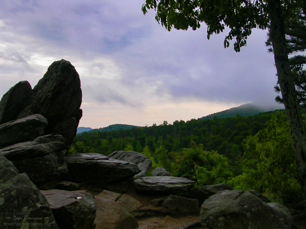
You can plan the same kind of trip on the north side. Starting at Front Royal, work your way down Skyline Drive and take one of many trails to either a mountain top, old cabins or alongside a stream. The hiking options in the northern part of the park are somewhat limited to longer hikes, so the central portion of the park is better if you want a variety of hikes. If you want to see waterfalls and don’t want to hike more than 4 miles, your best bet is the 1.4 mile Dark Hollow Falls Trail in the Big Meadows area in the middle of the park. Like the southern portion of the park, Skyline Drive is the major thoroughfare, and it is littered with overlooks. My favorites in this half of the park were Hazel Mountain Overlook and Jewell Hollow Overlook because they not only overlook great vistas but have interesting foreground in the form of rock formations just off the road.
Suggestions. Skyline Drive offers some great views, but it can be crowded, especially in the fall. Be careful when turning left to enter an overlook area as there are many blind curves. Also, this is a very popular biking area, so keep your speed down and your eyes on the road when driving.
When you’ve taken in enough of the views from the overlooks (which don’t differ much), get off the road and take a trail. On a sunny day, hike up to a mountain peak for spectacular views. On a cloudy day, hike down alongside a stream. The clouds accentuate the deepness of the forest, and you can use the diffused lighting to get some great photos of wildflowers and waterfalls.
What you will see in the park depends greatly on the time of year you visit. Most visit in the fall for the brilliant colors. Spring is another good time to visit because many trees will be flowering, adding to the mix of wildflowers on the forest floor. Unfortunately, there don’t appear to be any places where there are fields of wildflowers, just plants here and there, and the weather in spring can be uncooperative.
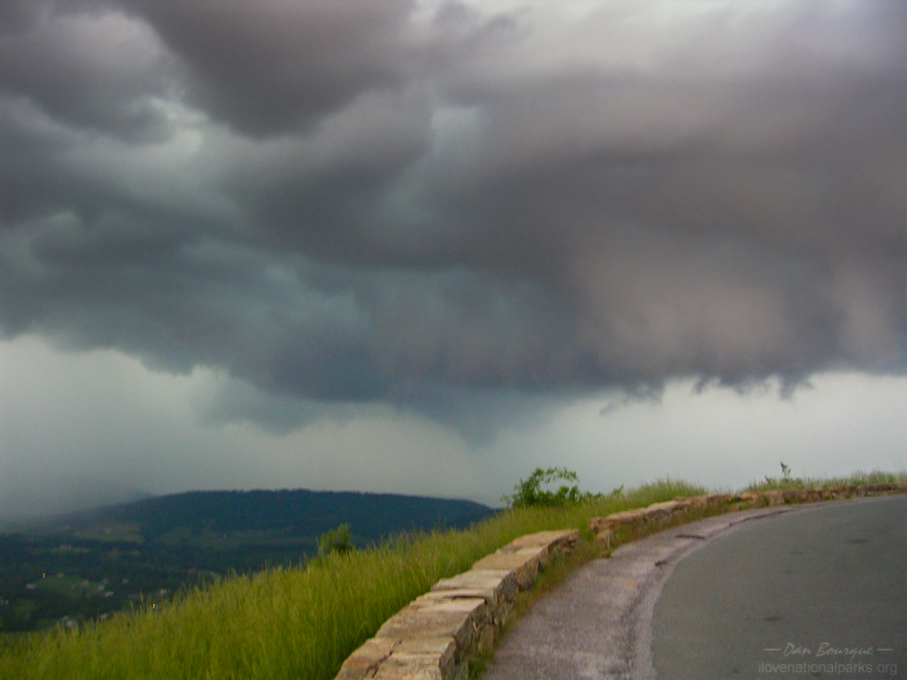
I talked with one couple at an overlook, and they said that of the five times they’d driven Skyline Drive, four were overcast and rainy. Bring a jacket, and prepare for rain any time of year (and some snow in the winter). Also, beware of thunderstorms, especially in the summer. Skyline Drive is up on the tallest ridge, so it can leave you very exposed when the lightning rolls in. On my second trip, there was a tornado watch in the county just west of Shenandoah, and I felt a bit frightened for about 15 minutes when it was pouring, the black clouds were rolling in, and I had nowhere to go for shelter.
Stories You can run from the tornado, but you’ll only die tired
Nearby Towns Front Royal, Waynesboro, Stanardsville, Sperryville, Elkton, Luray (Virginia)
Other Nearby Attractions Washington D.C., National Mall, Manassas NBP
Official NPS Website Shenandoah NP
-
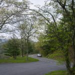
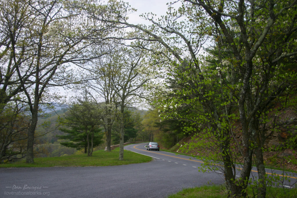
- Skyline Drive is a two-lane road that runs the ridgeline the length of the park. It’s the primary artery of the park, and most trails begin from the roadside (May)
-
- There are frequent pullouts for overlooks along the road. There’s not a lot to differentiate most of the overlooks from one another, so don’t worry if you miss one. This is near the Dundo Picnic Ground in the south end of the park (May)
-
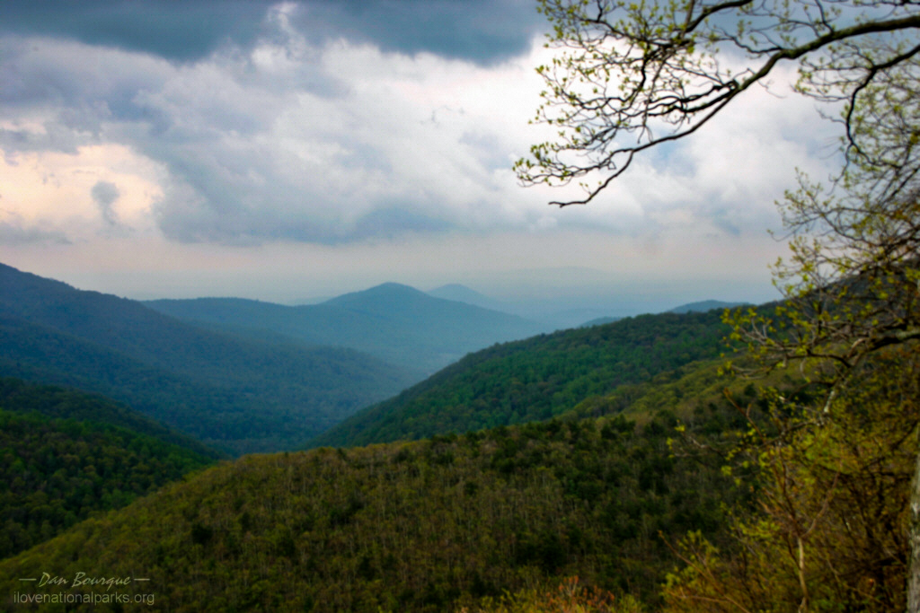
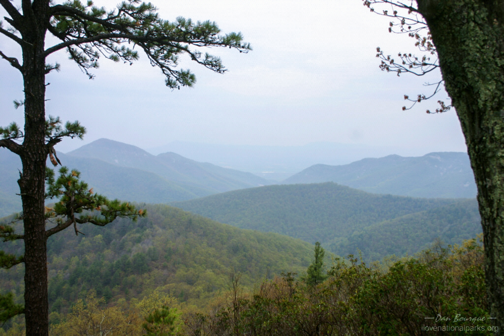
- This is the overlook for Moormans River. This was my favorite overlook on the south side of the park. This photo illustrates why they call this area the “Blue Ridge Mountains.” (May)
-
- One of many overlooks from Skyline Drive. This is the Ivy Creek overlook (May)
-
- This is part of the Doyles River Trail. In May, the trees near the road are just budding, but as you descend into the valleys, it becomes more green (May)
-

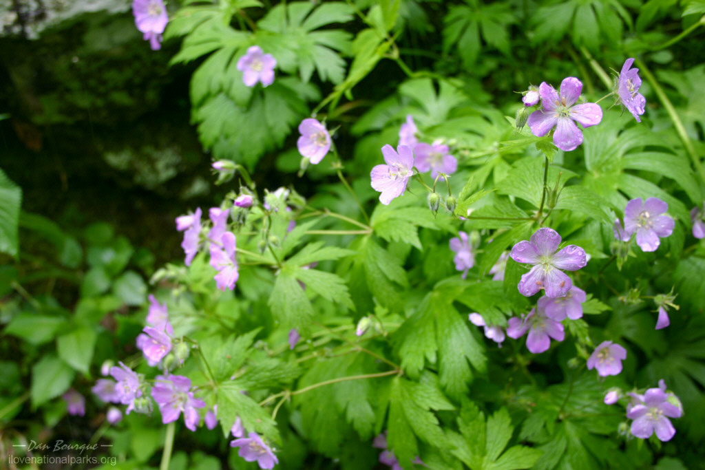
- Unidentified wildflowers along the Doyles River Trail. Wildflowers of numerous varieties dot the forest floor in spring and summer (May)
-

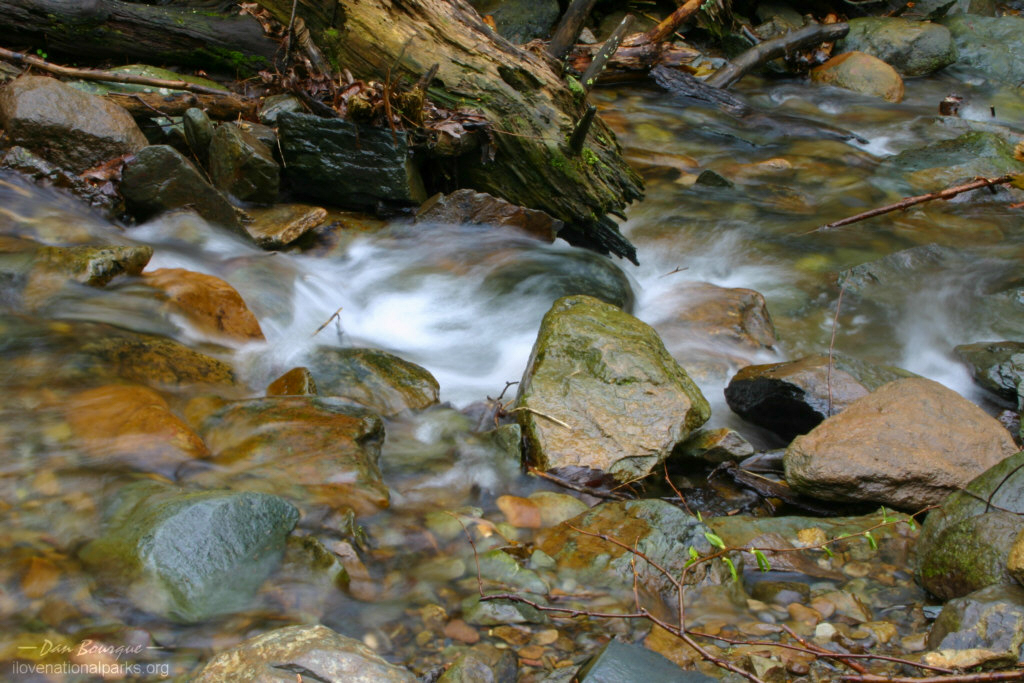
- The streams in Shenandoah run clear and cold. This is the tiny Doyles River above the falls (May)
-
- The 2.5 mile hike to Upper Doyles River Falls and back is a workout, but the falls are worth it. An overcast sky is ideal for photographing waterfalls because you can slow the exposure to “soften” the water (May)
-
- Upper Doyles River Falls (May)
-
- The hike to Lower Doyles River Falls adds another 1/2 mile and the toughest terrain to the hike, but the falls are nice (May)
-
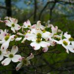
- Flowers on a dogwood tree. These trees bloom in April and May (May)
-
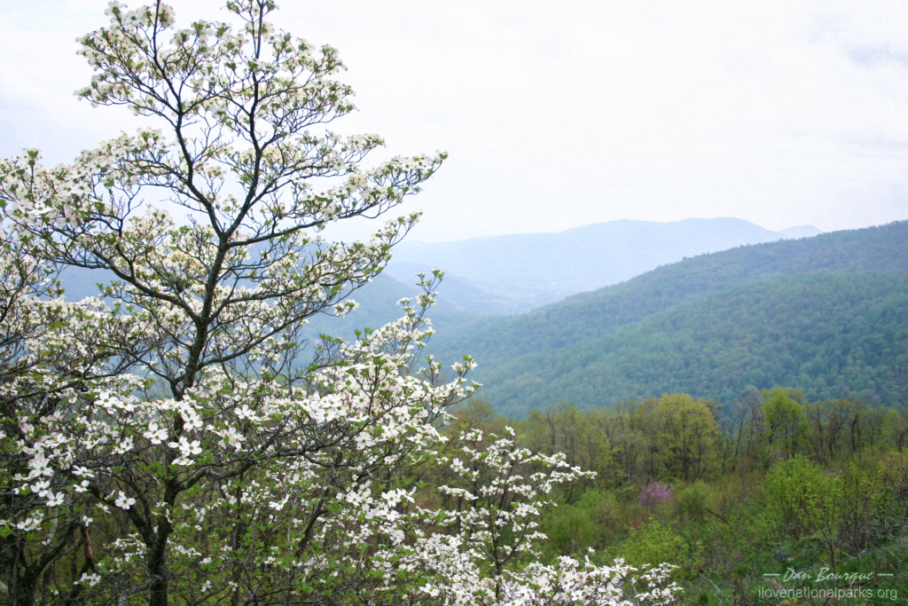
- Dogwoods like this one add some variety to the light greens of spring (May)
-
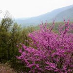
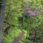
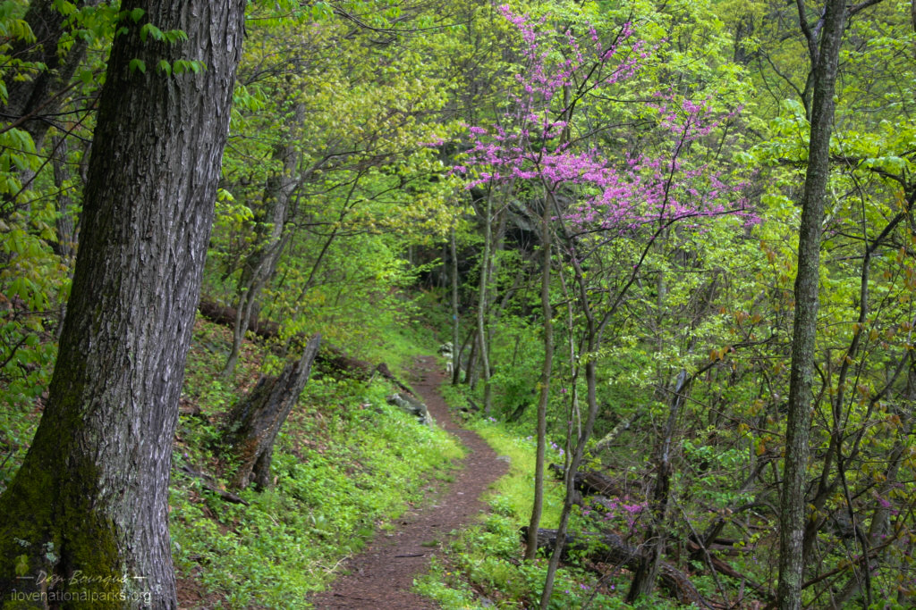
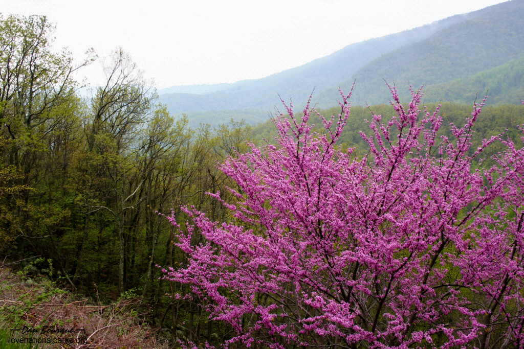
- Every once and a while, there are brilliant purple trees dotting the landscape in spring. This is right off Skyline Drive near the Bacon Hollow Overlook (May)
-
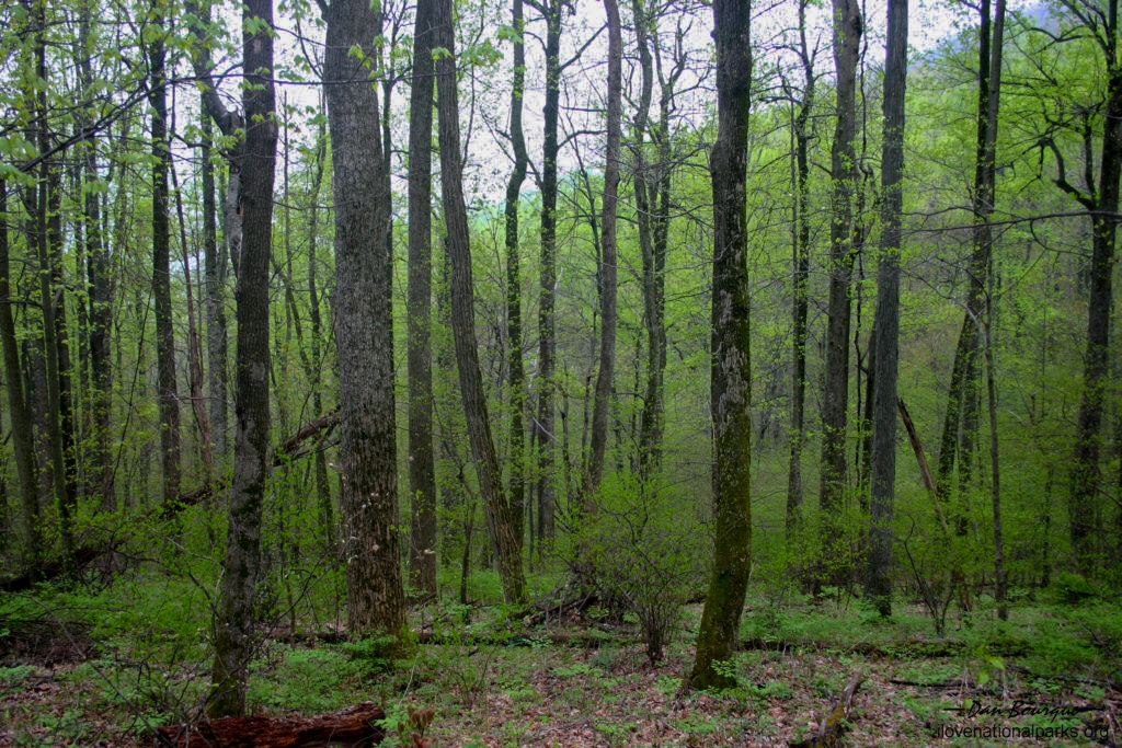
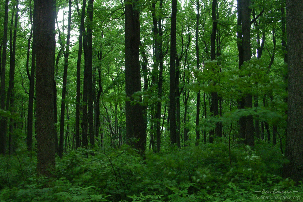
- While most of the forest in Shenandoah is second growth, it’s difficult to tell. Vegetation is lush and green in spring (May)
-
- A month makes a lot of difference in the spring. Compare the vegetation in this photo taken in June to the vegetation in the photo above taken in May (June)
-

- There was a tornado watch near the park when I visited in June, and I’m pretty sure this cloud was the one they were worried about. It was a little unnerving to pop out of the trees and be eye to eye with this monster with lightning flashing all around (June)
-
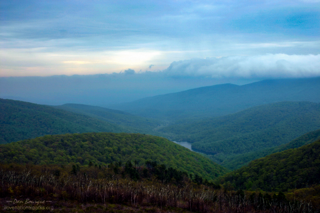
- After driving through a substantial thunderstorm, the rain faded, and the clouds began to lift to reveal the surrounding ridges and the colors of sunset (June)
-

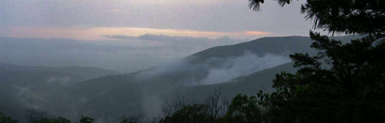
- Once the clouds lifted, they left parts of themselves tucked in the valleys. This picture doesn’t do justice to the sense of serenity after the rain (June)
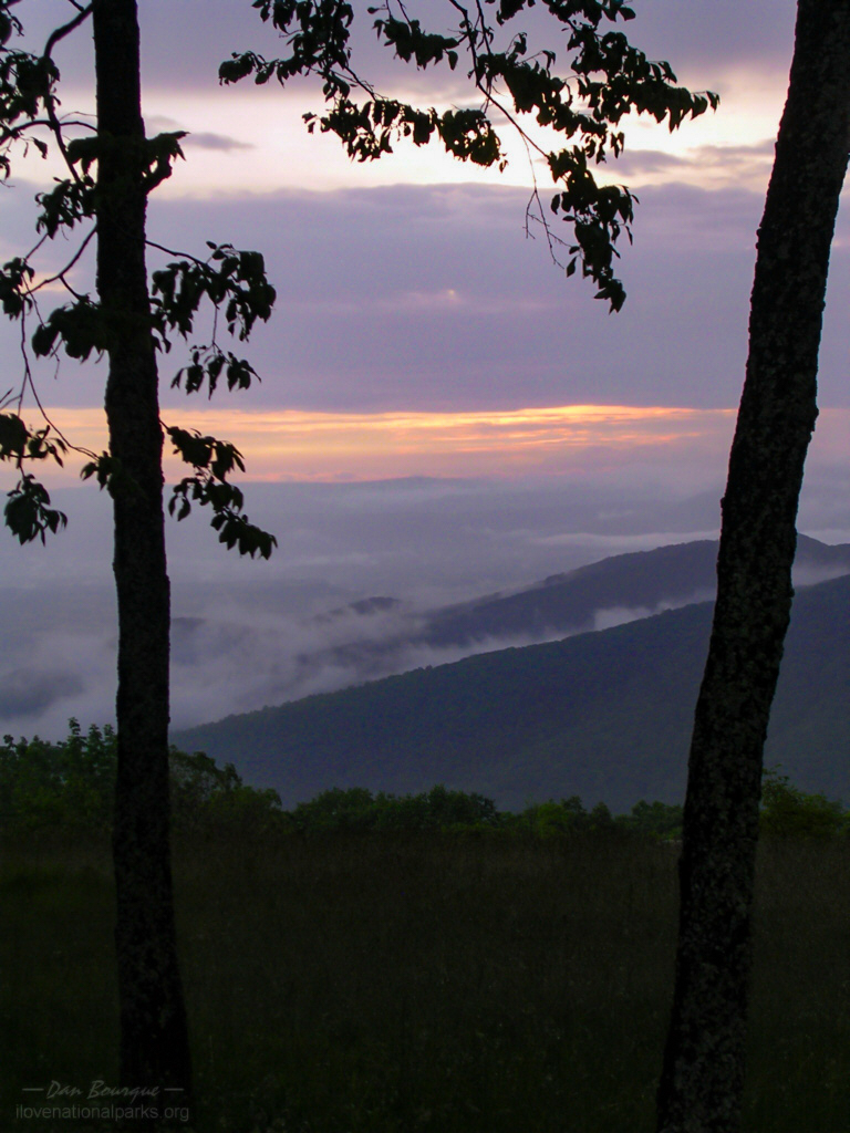
-
- Hazel Mountain Overlook after a heavy rain (June)
-
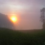
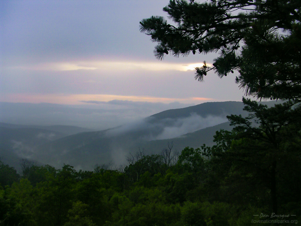
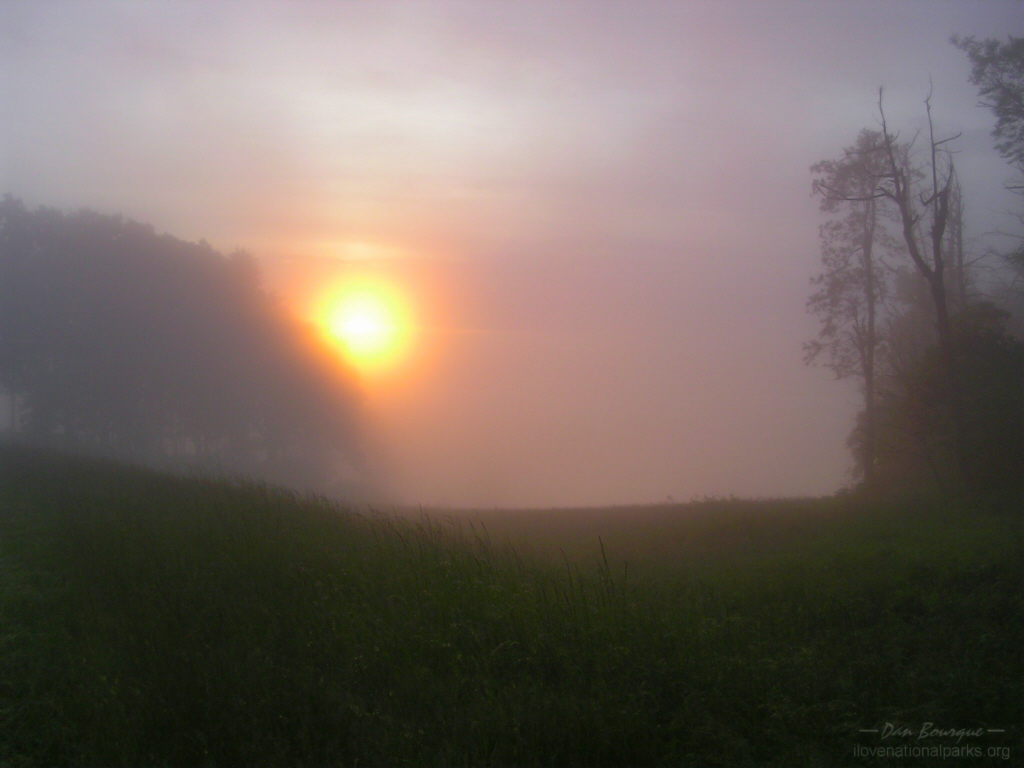
- Near the end of my southward excursion into the park, I ran into fog. As I turned a corner, a bright light began to penetrate the darkness, but it took me a minute to realize it was the sun. Eventually, this heavenly scene unfolded before me before the sun once again hid behind the clouds (June)
Write Your Own Review