
 G
G ulf Islands National Seashore was established in 1971 to protect both pristine coastal habitat and historic features along the gulf coast of Florida and Mississippi including 3 of the 42 historic fortifications built to protect the U.S. coast in the 1800s.
Visitor Rating (write your own review below)
ILNP Rating![]()
ILNP Park Review
Our Visit. I visted the portion of Gulf Islands National Seashore near Pensacola, Florida during a trip to the panhandle of Florida in October.
Our Weather. 85 degrees, overcast and a little rainy, but very tolerable
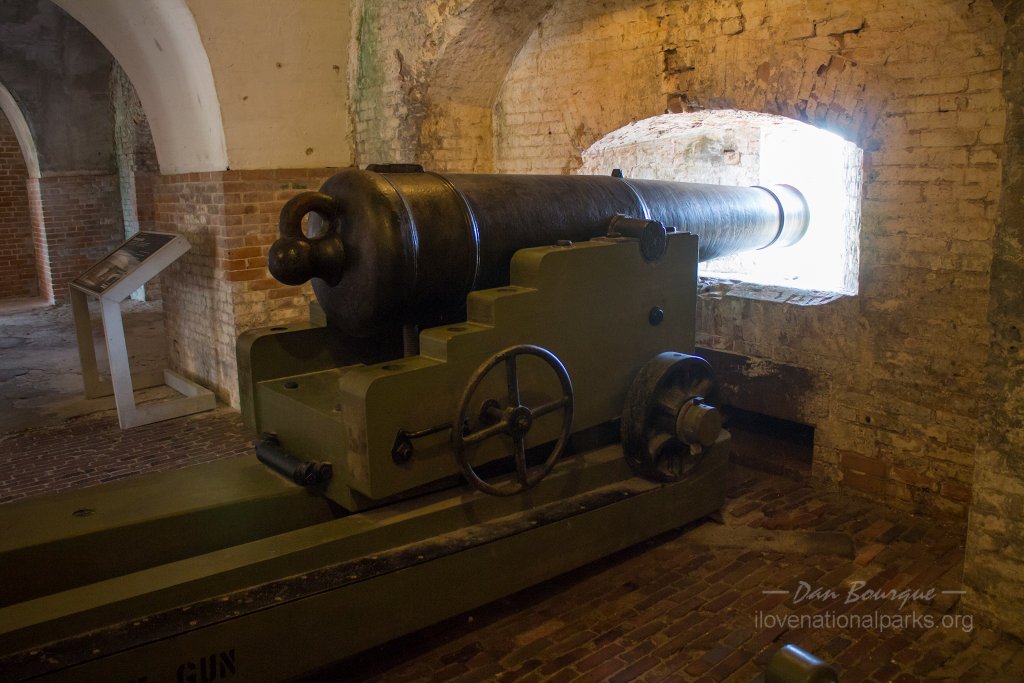
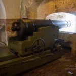
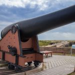
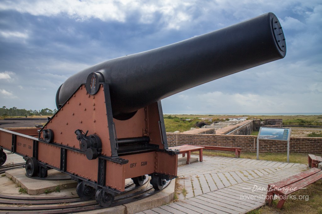
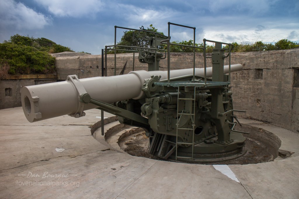
A cannon in firing position inside Fort Pickens.
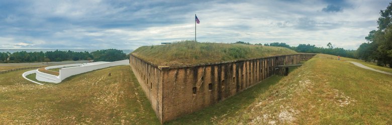
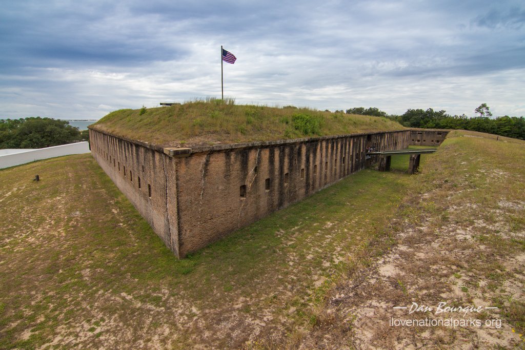
Overall Impression. The name Gulf Islands National Seashore conjures up images of white sand beaches, sea grass and teal waters. This park certainly has plenty of those things, but that’s not really what visiting this park is all about. There is as much at this park for the history buff as there is for the nature lover, and the three 1800s forts that once protected Pensacola Bay are the prominent features of Gulf Islands. A Civil War battle was even fought here in 1961 when Union troops at Fort Pickens opened fire on Confederate troops who had captured nearby Fort McRee and Fort Barrancas. The forts (except Fort McRee which has been swept into the Gulf) are well preserved and easy to explore, and the beaches are pristine making this park a real gem in an otherwise busting area.
 Visiting. Gulf Islands NS consists of several geographically separated areas on both the mainland and islands of Florida and Mississippi. The areas in Florida can mostly be reached by car, while all but one area of Mississippi can only be reached by boat. The most visited portion of the park is the western end of Santa Rosa Island near Pensacola, FL. This area contains the largest of the three forts, Fort Pickens. Across Pensacola Bay (on Pensacola Naval Air Station) are the two smaller forts. All of the areas near Pensacola can be visited in about 5 hours. If you have less time, you’ll probably be limited to just one area.
Fort Pickens Area
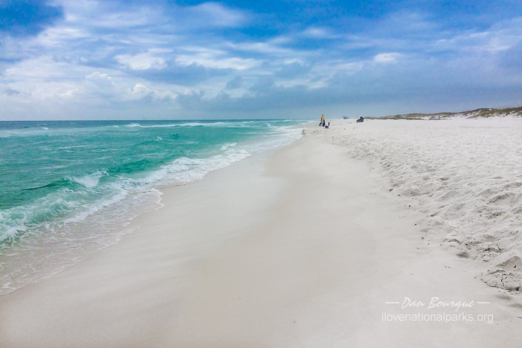
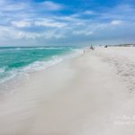
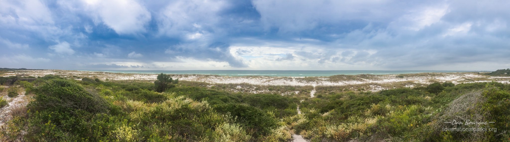
Langdon Beach lies in the Fort Pickens section of the park and exhibits some of the white sand this area is known for. The Florida National Scenic Trail runs across this beach.
The Fort Pickens section of the park lies on Santa Rosa Island adjacent to bustling Pensacola Beach. The main access to this end of the island is a toll bridge from the mainline (the toll was $1 when I went through). This section contains both the fort and most of the park’s beaches accessible by car. It’s also the only fee area I encountered in the park, and at the time I visited, the fee was a rather steep $15 per car. The road runs alongside wide beaches for several miles before you reach the fort, and the beaches are definitely worth a visit. I took some time to walk along the shore at Langdon Beach near the fort, and there were tables, shelter and outdoor showers to go along with the beautiful and uncrowded beach.
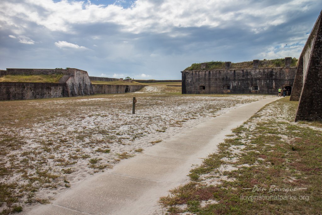
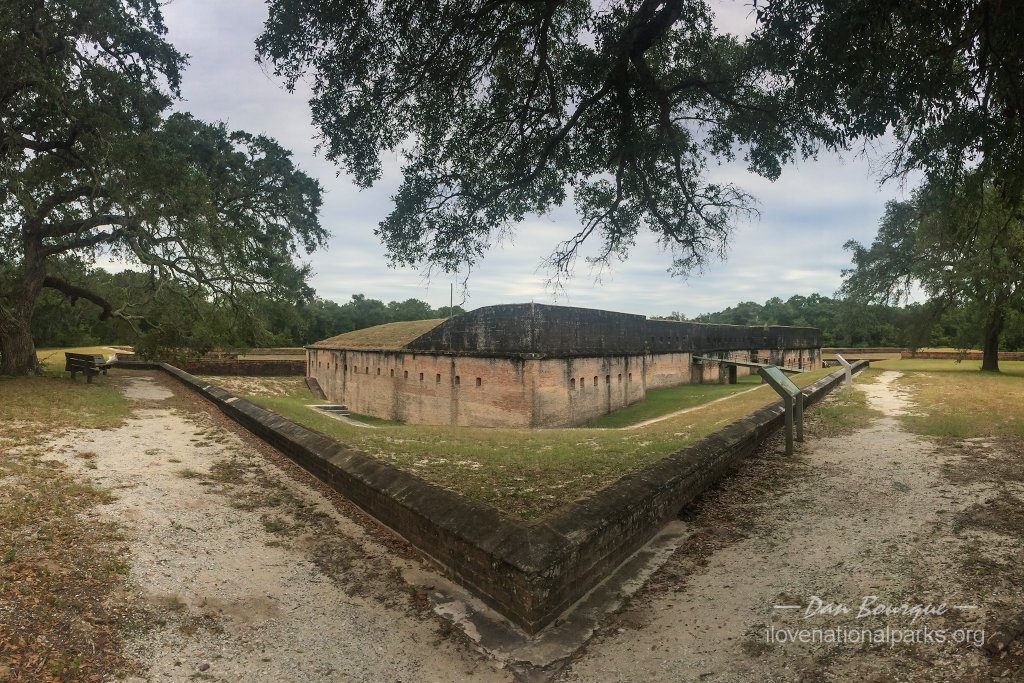
View of Fort Pickens from the ditch. Attackers would face a deadly crossfire in the ditch.
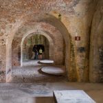
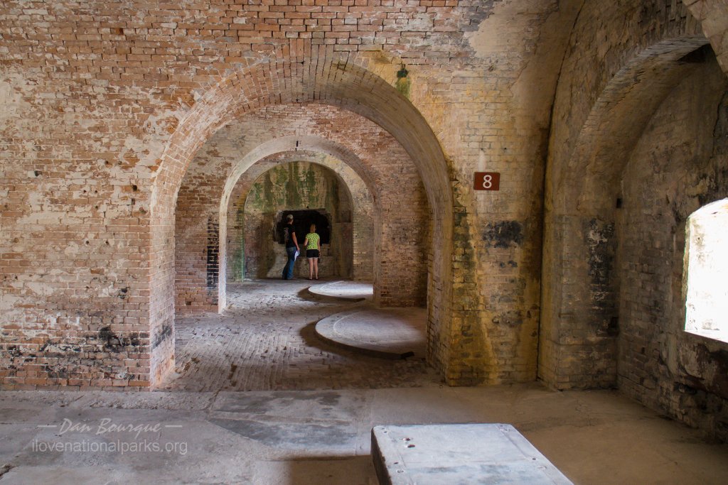
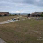
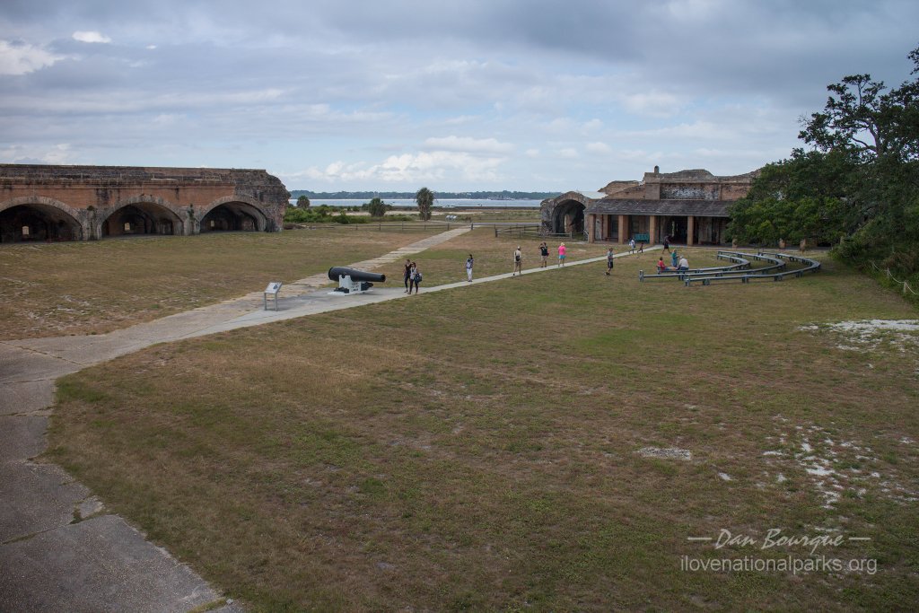
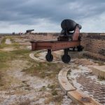
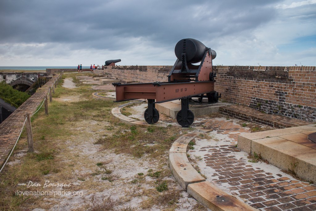
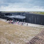
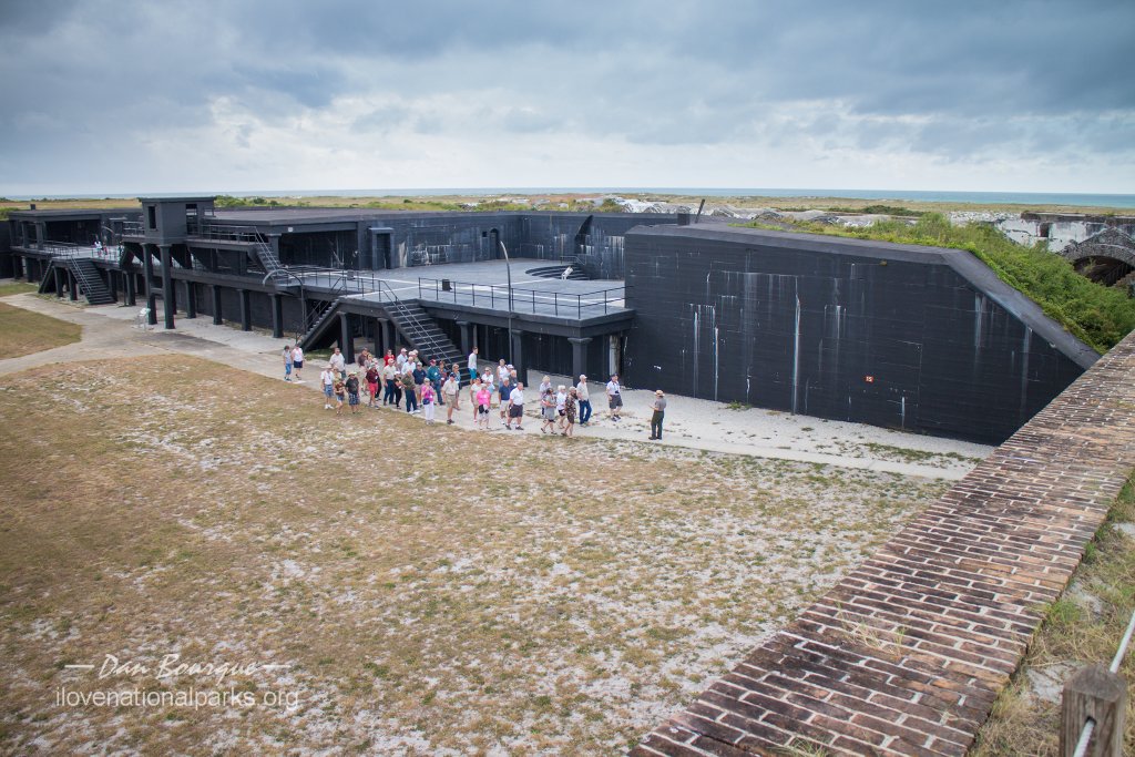
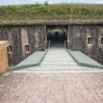
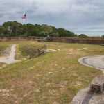
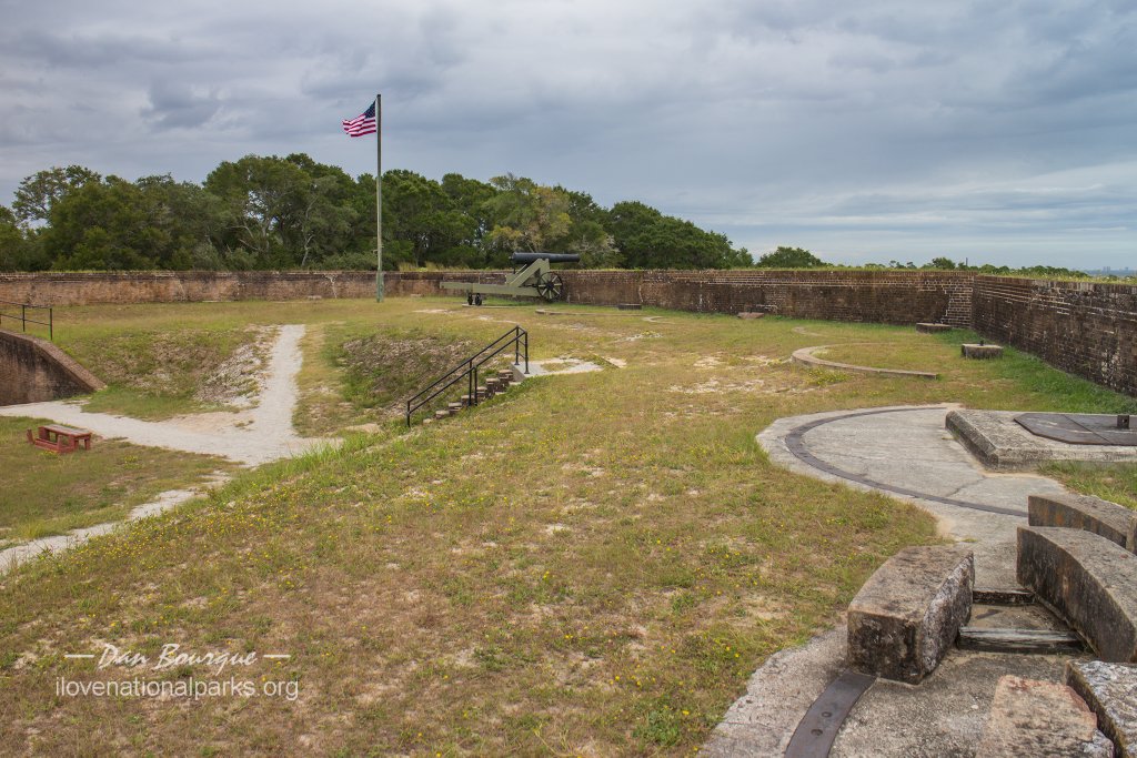
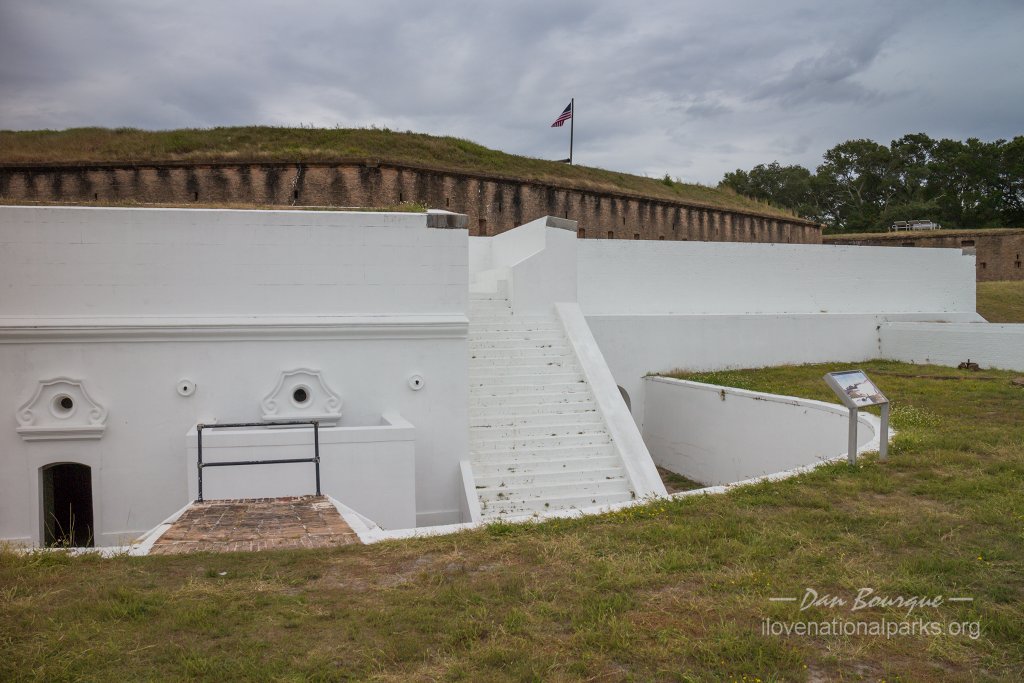
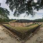
At the end of the road is Fort Pickens which is really the centerpiece of Gulf Islands NS. The fort is constructed almost entirely of brick, and you can walk through most of it. The park offers tours given by Rangers, or you can simply pick up a brochure for a self-guided tour and walk it on your own. The tour tells the story of these imposing structures and their state-of-the-art defensive design for the mid-1800s. While the nearby forts fell to the Confederates during the Civil War, Fort Pickens remained a Union stronghold in the south throughout the war. In the middle of the fort is Battery Pensacola, an ugly and boxy black structure that stands in contrast to the brick arches of the original fort. This more modern battery was built around 1900 to improve the defensibility of the fort’s guns. You can walk the tour in about 45 minutes without rushing, but it would be easy to spend 2 hours.
 Fort Pickens is also the starting point of the Florida National Scenic Trail which stretches more than 1,000 miles across the state. It starts right from the parking lot, though I had expected it to be better marked.
Along the road between the entrance station and the fort are several concrete batteries and fortifications built in the early 1900s. While I wouldn’t recommend stopping at all of them unless that’s your thing, it’s worth stopping at at least one if for no other reason that to enjoy the view from the top. I stopped at Battery Cooper and wasn’t disappointed.
Fort Barrancas Area
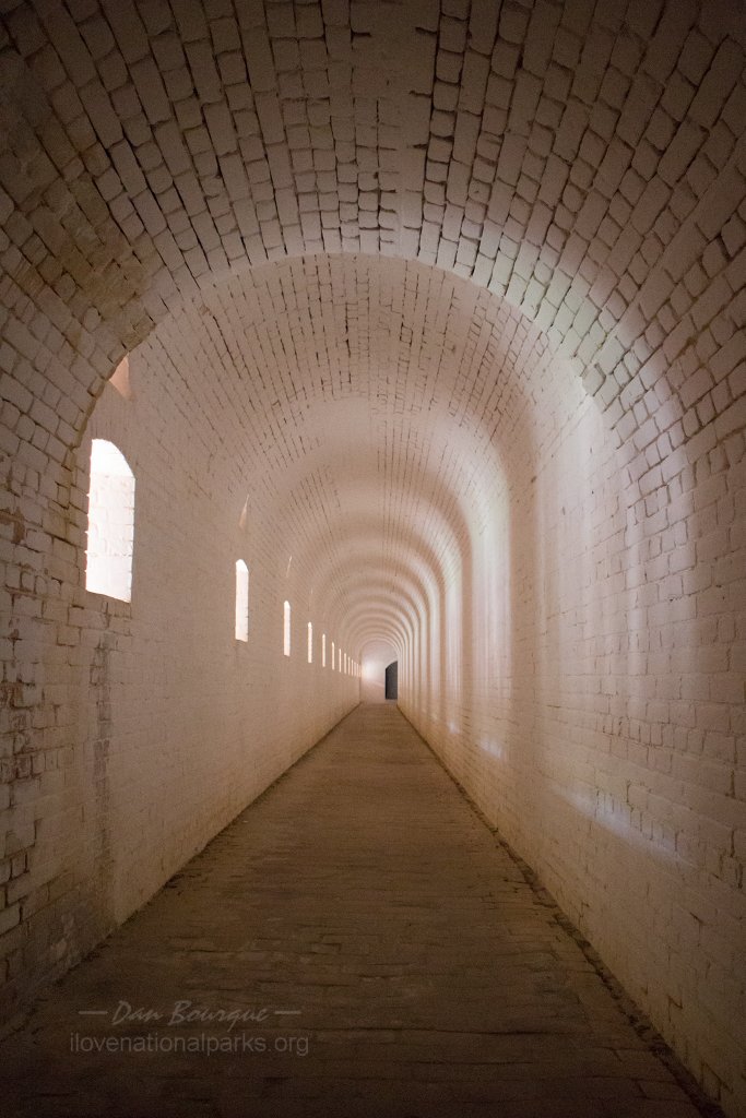
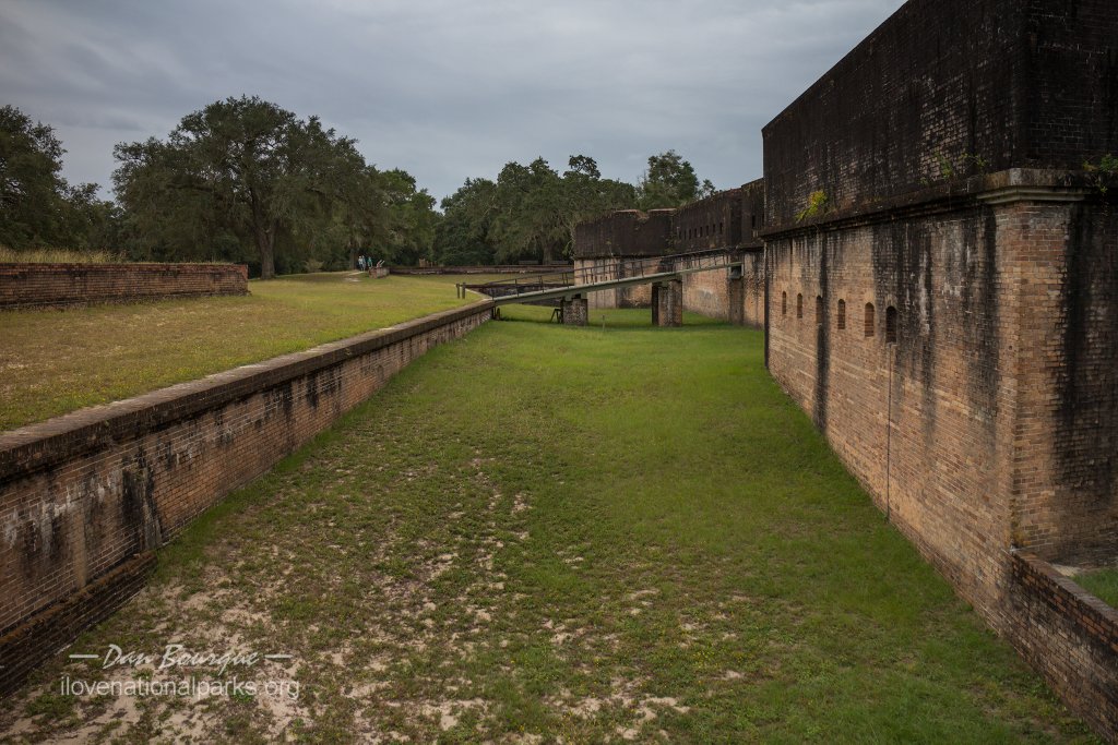
Opportunities for neat photos abound in the forts. This is looking down the long hallway of the counterscarp at Fort Barrancus.
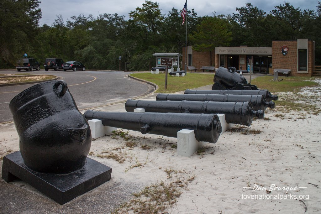
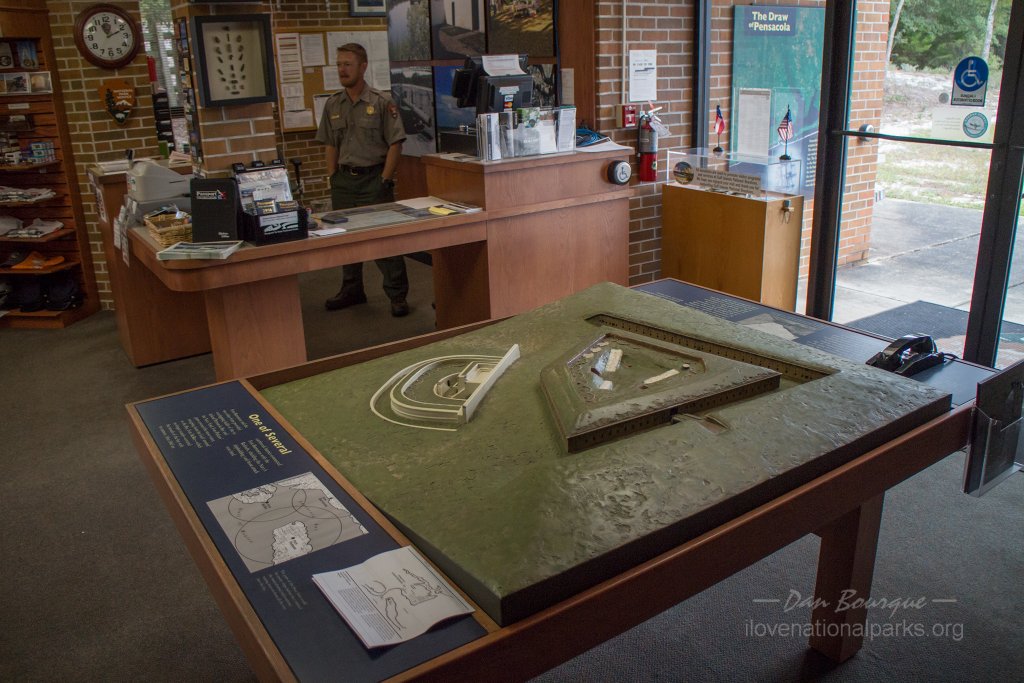
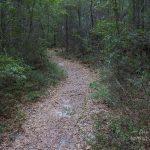
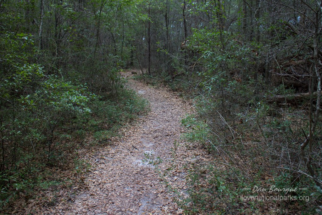
Fort Barrancas is on the mainland and and was built to defend both the entrance to the bay and the Pensacola Naval Yard. While only 1.5 miles from Fort Pickens, it’s a good 90 minute drive between them. It lies on Naval Air Station Pensacola and can only be accessed through the military gates. However, this area of the base also houses the popular Naval Aviation Museum and is open to visitors. Fort Barrancas is considerably smaller than Fort Pickens, but it’s also a lot less crowded, and there’s no fee to visit. A short path connects the visitors center to the fort which is accessed via a drawbridge. Like Pickens, most parts of Barrancas are open, and a brochure for self-guided tours helps visitors understand what they’re seeing. Barrancas was built adjacent to an old Spanish fort (now called the Water Battery) which is also accessible if you’re willing to descend a steep tunnel with many stairs to get to it. Budget about 60-90 minutes to explore the fort. Near the visitors center is the Woodland Trail which offers a short loop hike through the woods. It’s nothing special, but it was cool in the shade, and it was interesting to see a forest floor covered in lichens.
Also in the Fort Barrancas area and just a short drive away is the Advanced Redoubt. Unlike the other forts which pointed toward the sea, this fort was designed to repel land invaders and protect the other forts. The Advanced Redoubt has no visitors center and isn’t open like the others. Still, it’s worth the 15-minute stroll around the fort to see the intricate design of its defenses and how they differ from the other forts.
Naval Live Oaks Area
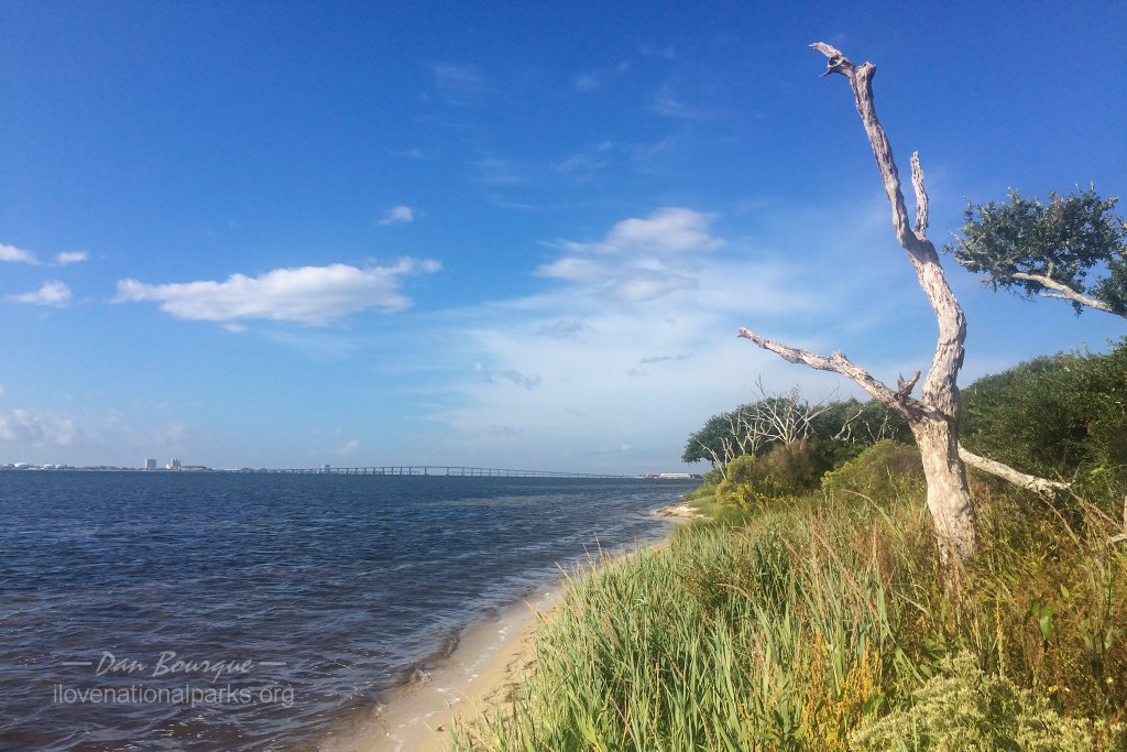
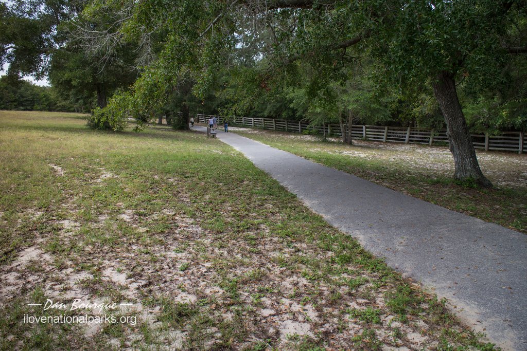
View of the “beach” along Santa Rosa Sound as seen from the Boardwalk Trail in the Naval Live Oaks section of the park.
The Naval Live Oaks section of the park is on the mainline opposite Santa Rosa Island. There are a few trails and picnic areas in this section, but in my opinion, your time is best spent elsewhere. I hiked the short Boardwalk Trail adjacent to the visitors center. It was shaded and cool, though a bit humid. The trail takes you to the beach along Santa Rosa Sound, but the beach here is only a few feet wide and nothing like those in the Fort Pickens area.
Barrier Islands Area
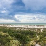
This section of the park is off the coast of Mississippi and comprises several islands including Cat, West Ship, East Ship, Horn and Petit Bois Islands. A ferry from Gulfport, MS, connects visitors to West Ship, but the other islands are only accessible by private boat or charter. The islands offer even more pristine and primitive beaches than those in the Fort Pickens area.
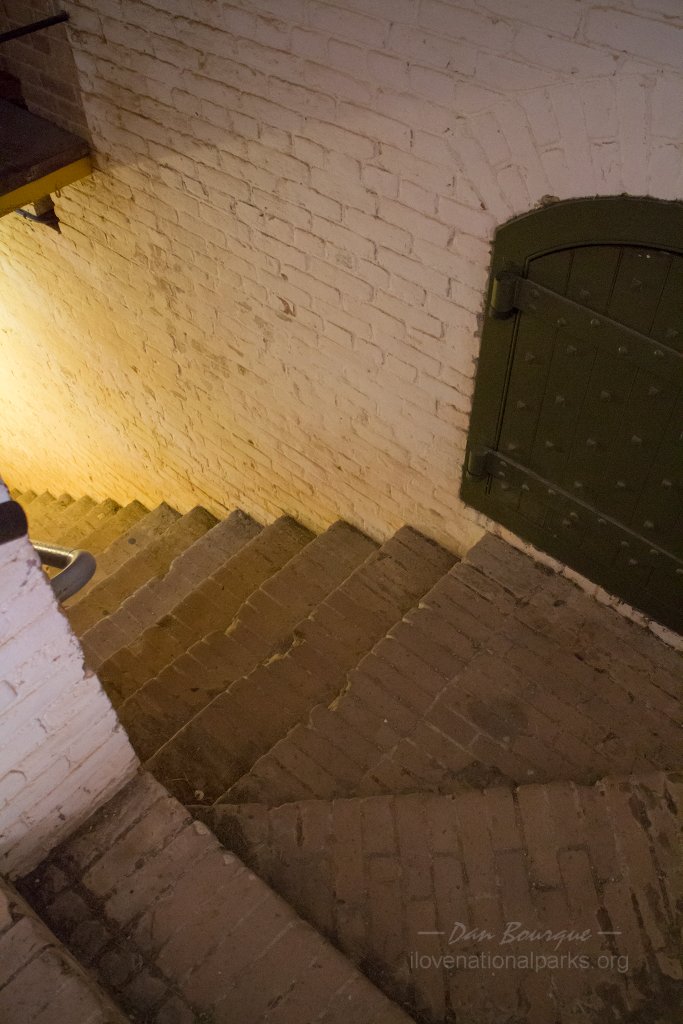
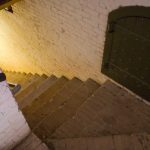
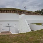
Many of the stairs in the forts are steep like these at Barrancus.
Suggestions. Choose your area carefully to fit into your time budget and align with your interests. Those looking for beautiful beaches accessible by car will want to head right to the Fort Pickens area, while those interested history and museums would probably be just as content visiting Fort Barrancas outside of the fee area. If you do explore the forts, many of the stairs are narrow and STEEP, so watch your step.
Be patient driving, especially in the Fort Pickens area. It’s a 7 mile, 2-lane road with no passing lanes and sometimes heavy traffic including RVs, so just expect a few delays. If you’re driving from Fort Pickens to Fort Barrancus, it will take you a long time to get there. If you find yourself driving out of town on a two-lane road and thinking you’re lost, you’re almost there–the map app on my phone found it just fine and took my by the route accessible to civilians.
 If you like planes at all and are planning to visit Fort Barrancus, make sure to leave a couple of hours to tour the National Naval Aviation Museum on NAS Pensacola. It’s only 1/2 mile from the fort, and it’s a world-class museum full of hundreds of historic aircraft and first-rate displays.
Nearby Towns Pensacola (FL), Biloxi, Gulfport, Pascagoula (MS)
Other Nearby Attractions National Naval Aviation Museum
Official NPS Website Gulf Islands National Seashore
-
- Langdon Beach lies in the Fort Pickens section of the park and exhibits some of the white sand this area is known for. The Florida National Scenic Trail runs across this beach.
-
- The inside of one of the bastions showing the cannon ports. The wheels rotated on semi-circle slabs of marble.
-
- A cannon in firing position inside Fort Pickens.
-
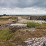
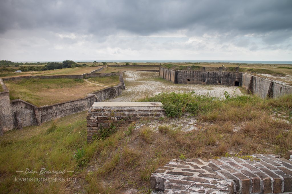
- The “ditch” at Fort Pickens as seen from atop the battlement of the main fort.
-
- The yard inside Fort Pickens. Note the mission walls and bastion–they were lost in 1899 when a fire set off a powder explosion.
-
- View of one of the larger guns atop Fort Pickens looking back toward the Gulf of Mexico.
-
- You can climb up to the top of the fort in a couple of places including this wall which faces west.
-
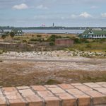
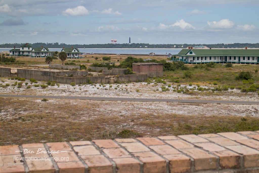
- View looking west across Pensacola Bay showing the historic Army houses and lighthouse.
-
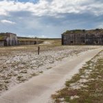
- View of Fort Pickens from the ditch. Attackers would face a deadly crossfire in the ditch.
-
- To deal with modern weaponry, the Army added Battery Pensacola to the interior of Fort Pickens around the turn of the 19th century.
-
- A panoramic view of the seashore and its vegetation shot from the Battery Cooper area of the Fort Pickens section.
-
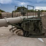
- One of the more “modern” (20th century) guns that defended Pensacola from Battery Cooper. This gun could load while protected and “pop up” to engage targets.
-
- Fort Barrancus is accessible from this paved and easy path from the visitors center.
-
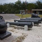
- Cannons and mortar on display at the Barrancus Visitors Center
-
- The Barrancus Visitors Center is small but still worth a visit. This scale model of the fort gives a good orientation before exploring it on your own.
-
- The walls of Fort Barrancus looking across the ditch from atop the counterscarp
-
- Yes, that is a drawbridge, and it’s the only way into the main part of Fort Barrancus.
-
- Many of the stairs in the forts are steep like these at Barrancus.
-
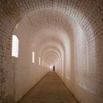
- Opportunities for neat photos abound in the forts. This is looking down the long hallway of the counterscarp at Fort Barrancus.
-
- The view on the inside of Fort Barrancus. Many of the fort’s cannons were stationed out in the open.
-
- Fort Barrancus was built adjacent to an older Spanish fort which was absorbed into the Barrancus defenses as the Water Battery.
-
- This is the Woodland Trail near the Barrancus Visitors Center. It’s shaded and pleasant, but nothing spectacular.
-
- Fisheye view of the Advanced Redoubt near Fort Barrancus.
-
- Looking down the ditch at the Advanced Redoubt. This was considered state-of-the-art when first built in the late 1800s.
-
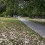
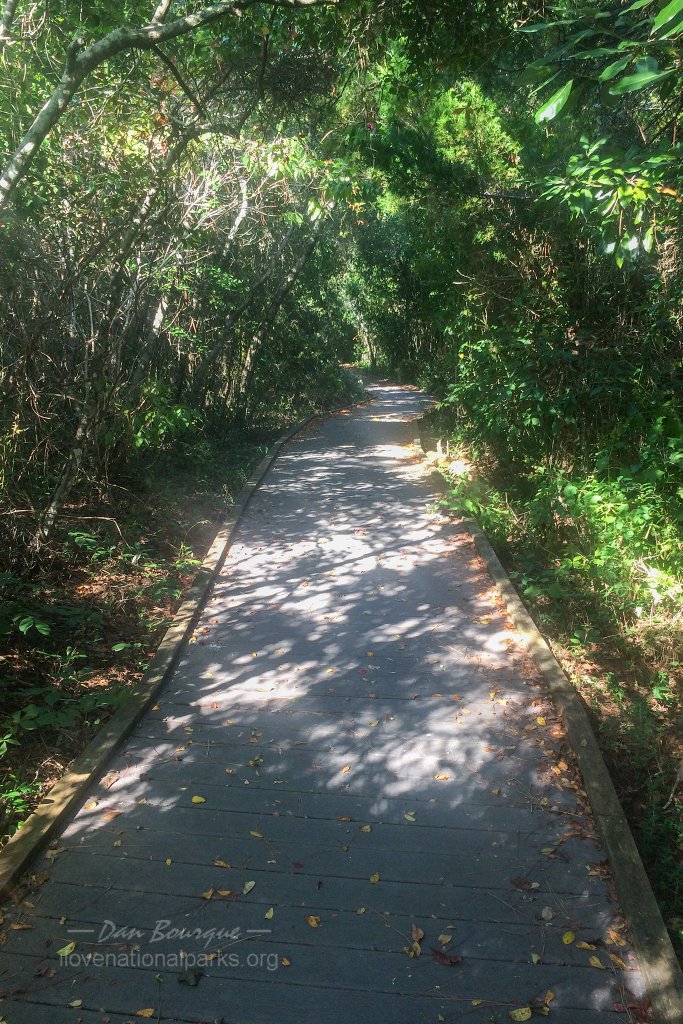
- The Boardwalk Trail is a short loop from the visitors center in the Naval Live Oaks section of the park. It’s a short, shady walk with a few signs to introduce visitors to some of the historical and biological facts of this area.
-
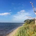
- View of the “beach” along Santa Rosa Sound as seen from the Boardwalk Trail in the Naval Live Oaks section of the park.
Write Your Own Review
No Comments Yet